
National Weather Service · LOX
Coastal waters
PZZ650 · East Santa Barbara Channel
Issued
.TONIGHT: SW wind 5 to 10 kt, becoming SE after midnight. Seas 2 to 3 ft. Wave Detail: W 2 ft at 10 seconds and S 2 ft at 15 seconds. A slight chance of showers late this evening. A chance of showers after midnight.
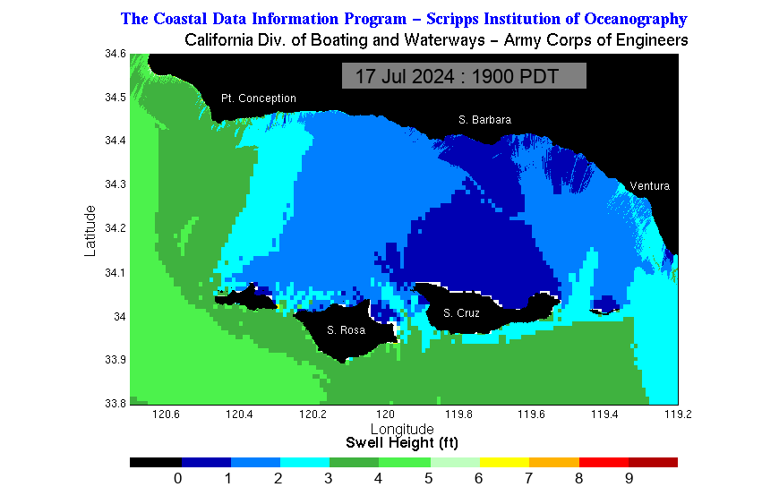
Regional wind and sea state—not breaking surf at an individual beach.
Read PZZ650 forecast
PZZ650-211630- East Santa Barbara Channel from Pt. Conception to Pt. Mugu CA including Santa Cruz Island- 908 PM PDT Tue Oct 20 2026
...SMALL CRAFT ADVISORY IN EFFECT FROM WEDNESDAY MORNING THROUGH WEDNESDAY EVENING...
.TONIGHT: SW wind 5 to 10 kt, becoming SE after midnight. Seas 2 to 3 ft. Wave Detail: W 2 ft at 10 seconds and S 2 ft at 15 seconds. A slight chance of showers late this evening. A chance of showers after midnight.
.WED: SE wind 10 to 15 kt, becoming 15 to 25 kt in the afternoon. Seas 2 to 4 ft. Wave Detail: SE 3 ft at 5 seconds and W 2 ft at 13 seconds. Showers with a slight chance of tstms.
.WED NIGHT: E wind 10 to 20 kt. Gusts to 25 kt in the evening. Seas 3 to 5 ft. Wave Detail: SE 3 ft at 5 seconds, W 2 ft at 12 seconds and S 2 ft at 14 seconds. Rain with a slight chance of tstms.
.THU: Light winds, becoming NW 10 to 20 kt in the afternoon. Seas 2 to 3 ft. Wave Detail: NW 2 ft at 4 seconds, W 2 ft at 11 seconds and S 2 ft at 15 seconds. A slight chance of tstms. Rain.
.THU NIGHT: W wind 10 to 20 kt, becoming NW 15 to 25 kt after midnight. Seas 2 to 4 ft. Wave Detail: W 3 ft at 5 seconds.
.FRI: Western Portion, NW wind 15 to 20 kt. Eastern Portion, NW wind 5 to 10 kt. Seas 2 to 4 ft. Wave Detail: NW 3 ft at 7 seconds and W 2 ft at 8 seconds.
.FRI NIGHT: NW wind 20 to 30 kt, becoming N 10 to 15 kt after midnight. Seas 4 to 6 ft, subsiding to 3 to 4 ft. Wave Detail: NW 5 ft at 7 seconds.
.SAT: Light winds. Seas 2 to 3 ft. Wave Detail: W 3 ft at 9 seconds.
.SAT NIGHT: NW wind 5 to 10 kt. Seas 2 to 3 ft. Wave Detail: NW 2 ft at 5 seconds and W 2 ft at 11 seconds.
.SUN: NE wind 5 to 10 kt in the morning, becoming light. Seas 2 ft. Wave Detail: W 2 ft at 5 seconds.
.SUN NIGHT: NW wind 5 to 10 kt. Seas 2 to 3 ft. Wave Detail: NW 2 ft at 5 seconds.
Winds and seas higher in and near tstms.
Original bulletin · all LOX zones
000
FZUS56 KLOX 210408
CWFLOX

Coastal Waters Forecast for California
National Weather Service Los Angeles/Oxnard CA
908 PM PDT Tue Oct 20 2026

Point Piedras Blancas to San Mateo Point CA out 60 NM including the
Channel Islands National Marine Sanctuary.

PZZ600-211630-
908 PM PDT Tue Oct 20 2026

.Synopsis for the southern California coast and Santa Barbara
Channel including the Channel Islands National Marine Sanctuary
and National Park...At 03Z or 8 PM PDT, there was a 1007 mb low was
550 NM W of Los Angeles CA. This low and associated cold front will
impact our coastal waters late tonight through Thursday, bringing the
potential for heavy showers, thunderstorms, and possible
waterspouts.

$$

PZZ645-211630-
Point Piedras Blancas to Point Sal westward out to 10 NM-
908 PM PDT Tue Oct 20 2026

.TONIGHT...Light winds, becoming SE 5 to 10 kt after midnight. Seas
5 to 7 ft. Wave Detail: NW 6 ft at 13 seconds and S 3 ft at
15 seconds. A chance of showers late this evening. Showers likely
after midnight.
.WED...SE wind 10 to 15 kt. Seas 5 to 7 ft. Wave Detail: S 4 ft at
6 seconds, NW 5 ft at 12 seconds and S 3 ft at 14 seconds. Showers
with a slight chance of tstms.
.WED NIGHT...SE wind 5 to 10 kt, becoming NE 10 to 15 kt after
midnight. Seas 4 to 6 ft. Wave Detail: S 3 ft at 5 seconds, W 4 ft
at 11 seconds and S 3 ft at 14 seconds. Rain with a slight chance
of tstms.
.THU...Light winds, becoming NW 10 to 20 kt in the afternoon. Seas
4 to 5 ft. Wave Detail: NW 2 ft at 5 seconds, W 3 ft at 10 seconds
and S 3 ft at 15 seconds. Rain.
.THU NIGHT...NW wind 15 to 25 kt. Seas 4 to 5 ft. Wave Detail: NW
4 ft at 6 seconds, NW 3 ft at 11 seconds and S 3 ft at 15 seconds.
A chance of showers in the evening.
.FRI...NW wind 10 to 20 kt. Seas 4 to 6 ft. Wave Detail: NW 5 ft at
8 seconds and S 3 ft at 16 seconds.
.FRI NIGHT...NW wind 15 to 25 kt, becoming N 10 to 15 kt after
midnight. Seas 5 to 7 ft. Wave Detail: NW 6 ft at 9 seconds and S
2 ft at 16 seconds.
.SAT...N wind 10 to 15 kt, becoming NW 5 to 10 kt in the afternoon.
Seas 4 to 6 ft. Wave Detail: NW 6 ft at 10 seconds and S 2 ft at
15 seconds.
.SAT NIGHT...NW wind 10 to 15 kt in the evening, becoming light.
Seas 4 to 5 ft. Wave Detail: NW 5 ft at 10 seconds and S 2 ft at
15 seconds.
.SUN...NE wind 5 to 10 kt in the morning, becoming light. Seas 3 to
4 ft. Wave Detail: NW 3 ft at 10 seconds and S 2 ft at 14 seconds.
.SUN NIGHT...NW wind 5 to 10 kt in the evening, becoming light.
Seas 3 to 4 ft. Wave Detail: NW 3 ft at 10 seconds and S 2 ft at
14 seconds.

Winds and seas higher in and near tstms.

$$

PZZ670-211630-
Point Piedras Blancas to Point Sal from 10 to 60 NM-
908 PM PDT Tue Oct 20 2026

.TONIGHT...Light winds, becoming SE 5 to 10 kt after midnight. Seas
7 to 9 ft. Wave Detail: NW 8 ft at 13 seconds and S 3 ft at
15 seconds. A chance of showers late this evening. Showers with a
slight chance of tstms after midnight.
.WED...SE wind 10 to 20 kt. Seas 7 to 8 ft. Wave Detail: SE 4 ft at
6 seconds, NW 7 ft at 12 seconds and S 3 ft at 14 seconds. Showers
with a slight chance of tstms.
.WED NIGHT...SE wind 5 to 10 kt, becoming N after midnight. Seas
5 to 6 ft. Wave Detail: SE 3 ft at 6 seconds, NW 4 ft at 11 seconds
and S 3 ft at 14 seconds. A slight chance of tstms in the evening.
Rain.
.THU...N wind 5 to 10 kt, becoming NW 10 to 15 kt in the afternoon.
Seas 5 ft. Wave Detail: NW 2 ft at 5 seconds, NW 4 ft at 10 seconds
and S 3 ft at 15 seconds. Rain in the morning, then a chance of
rain in the afternoon.
.THU NIGHT...NW wind 15 to 20 kt. Seas 5 to 6 ft. Wave Detail: NW
5 ft at 7 seconds, NW 3 ft at 11 seconds and S 3 ft at 15 seconds.
.FRI...NW wind 10 to 20 kt. Seas 6 to 7 ft. Wave Detail: NW 7 ft at
7 seconds, NW 2 ft at 13 seconds and S 3 ft at 15 seconds.
.FRI NIGHT...NW wind 15 to 20 kt, becoming N 10 to 20 kt after
midnight. Seas 7 to 8 ft. Wave Detail: NW 7 ft at 10 seconds and S
3 ft at 16 seconds.
.SAT...N wind 5 to 10 kt. Seas 6 to 8 ft. Wave Detail: NW 7 ft at
10 seconds and S 3 ft at 15 seconds.
.SAT NIGHT...NW wind 5 to 10 kt. Seas 5 to 6 ft. Wave Detail: NW
5 ft at 10 seconds and S 2 ft at 15 seconds.
.SUN...Light winds. Seas 4 to 5 ft. Wave Detail: NW 4 ft at
10 seconds and S 2 ft at 14 seconds.
.SUN NIGHT...NW wind 5 to 10 kt. Seas 4 ft. Wave Detail: NW 3 ft at
5 seconds, NW 3 ft at 10 seconds and S 2 ft at 14 seconds.

Winds and seas higher in and near tstms.

$$

PZZ673-211630-
Waters from Pt. Sal to Santa Cruz Island CA and westward 60 nm
including San Miguel and Santa Rosa Islands-
908 PM PDT Tue Oct 20 2026

...SMALL CRAFT ADVISORY IN EFFECT FROM 5 AM PDT WEDNESDAY THROUGH
WEDNESDAY AFTERNOON...

.TONIGHT...Light winds, becoming SE 5 to 10 kt after midnight. Seas
6 to 8 ft. Wave Detail: NW 8 ft at 13 seconds and S 4 ft at
15 seconds. A chance of showers late this evening. Showers likely
with a slight chance of tstms after midnight.
.WED...SE wind 15 to 25 kt. Seas 6 to 8 ft. Wave Detail: SE 5 ft at
6 seconds, NW 7 ft at 12 seconds and S 3 ft at 14 seconds. Showers
with a slight chance of tstms.
.WED NIGHT...S wind 10 to 20 kt, becoming NW 10 kt after midnight.
Seas 5 to 7 ft. Wave Detail: S 3 ft at 5 seconds, NW 5 ft at
11 seconds and S 3 ft at 14 seconds. Rain with a slight chance of
tstms.
.THU...NW wind 5 to 10 kt, becoming 10 to 20 kt in the afternoon.
Seas 4 to 6 ft. Wave Detail: NW 2 ft at 5 seconds, NW 4 ft at
10 seconds and S 3 ft at 15 seconds. Rain in the morning, then a
chance of rain in the afternoon.
.THU NIGHT...NW wind 15 to 20 kt, becoming 20 to 25 kt after
midnight. Seas 5 to 7 ft. Wave Detail: NW 6 ft at 7 seconds, NW
4 ft at 11 seconds and S 3 ft at 15 seconds. A slight chance of
showers.
.FRI...NW wind 20 to 25 kt. Seas 5 to 7 ft. Wave Detail: NW 7 ft at
8 seconds, NW 2 ft at 12 seconds and S 3 ft at 15 seconds.
.FRI NIGHT...NW wind 20 to 30 kt, becoming N 15 to 25 kt after
midnight. Seas 7 to 8 ft. Wave Detail: NW 7 ft at 9 seconds and S
3 ft at 16 seconds.
.SAT...N wind 10 to 20 kt, becoming 5 to 10 kt in the afternoon.
Seas 6 to 8 ft. Wave Detail: N 2 ft at 5 seconds, NW 7 ft at
10 seconds and S 3 ft at 15 seconds.
.SAT NIGHT...NW wind 5 to 10 kt. Seas 5 to 7 ft. Wave Detail: NW
6 ft at 10 seconds and S 2 ft at 15 seconds.
.SUN...N wind 5 to 10 kt in the morning, becoming light. Seas 4 to
5 ft. Wave Detail: N 2 ft at 5 seconds, NW 5 ft at 10 seconds and S
2 ft at 14 seconds.
.SUN NIGHT...NW wind 5 to 10 kt, becoming 10 to 15 kt after
midnight. Seas 4 ft. Wave Detail: NW 3 ft at 5 seconds, NW 4 ft at
10 seconds and S 2 ft at 14 seconds.

Winds and seas higher in and near tstms.

$$

PZZ676-211630-
Outer waters from Santa Cruz Island to San Clemente Island to 60 NM
offshore including San Nicolas and Santa Barbara Islands-
908 PM PDT Tue Oct 20 2026

.TONIGHT...SW wind 5 to 10 kt, becoming S after midnight. Seas 5 to
7 ft. Wave Detail: NW 5 ft at 11 seconds and S 3 ft at 15 seconds.
A slight chance of showers late this evening. A chance of showers
after midnight.
.WED...SE wind 10 to 20 kt. Seas 5 to 7 ft. Wave Detail: SE 3 ft at
5 seconds, NW 5 ft at 13 seconds and S 3 ft at 14 seconds. Showers
with a slight chance of tstms.
.WED NIGHT...S wind 10 to 15 kt, becoming W after midnight. Seas
5 to 7 ft. Wave Detail: S 3 ft at 5 seconds, NW 5 ft at 11 seconds
and S 3 ft at 14 seconds. A slight chance of tstms. Rain.
.THU...NW wind 5 to 10 kt, becoming 10 to 15 kt in the afternoon.
Seas 4 to 5 ft. Wave Detail: NW 2 ft at 5 seconds, W 4 ft at
11 seconds and S 3 ft at 15 seconds. A slight chance of tstms. Rain
in the morning, then a chance of rain in the afternoon.
.THU NIGHT...NW wind 15 to 25 kt. Seas 4 to 6 ft. Wave Detail: NW
6 ft at 6 seconds, W 3 ft at 11 seconds and S 3 ft at 15 seconds. A
slight chance of showers.
.FRI...NW wind 15 to 25 kt. Seas 5 to 7 ft. Wave Detail: NW 6 ft at
7 seconds and S 2 ft at 15 seconds.
.FRI NIGHT...NW wind 15 to 25 kt. Seas 6 to 8 ft. Wave Detail: NW
7 ft at 8 seconds and S 3 ft at 15 seconds.
.SAT...N wind 10 to 15 kt, becoming 5 to 10 kt in the afternoon.
Seas 5 to 7 ft. Wave Detail: NW 6 ft at 9 seconds and S 3 ft at
15 seconds.
.SAT NIGHT...NW wind 5 to 10 kt. Seas 4 to 6 ft. Wave Detail: NW
3 ft at 5 seconds, NW 4 ft at 10 seconds and S 2 ft at 15 seconds.
.SUN...N wind 5 to 10 kt in the morning, becoming light. Seas 3 to
5 ft. Wave Detail: NW 3 ft at 5 seconds, NW 4 ft at 10 seconds and
S 2 ft at 14 seconds.
.SUN NIGHT...NW wind 5 to 10 kt. Seas 3 to 5 ft. Wave Detail: NW
3 ft at 5 seconds, NW 3 ft at 10 seconds and S 2 ft at 14 seconds.

Winds and seas higher in and near tstms.

$$

PZZ650-211630-
East Santa Barbara Channel from Pt. Conception to Pt. Mugu CA
including Santa Cruz Island-
908 PM PDT Tue Oct 20 2026

...SMALL CRAFT ADVISORY IN EFFECT FROM WEDNESDAY MORNING THROUGH
WEDNESDAY EVENING...

.TONIGHT...SW wind 5 to 10 kt, becoming SE after midnight. Seas
2 to 3 ft. Wave Detail: W 2 ft at 10 seconds and S 2 ft at
15 seconds. A slight chance of showers late this evening. A chance
of showers after midnight.
.WED...SE wind 10 to 15 kt, becoming 15 to 25 kt in the afternoon.
Seas 2 to 4 ft. Wave Detail: SE 3 ft at 5 seconds and W 2 ft at
13 seconds. Showers with a slight chance of tstms.
.WED NIGHT...E wind 10 to 20 kt. Gusts to 25 kt in the evening.
Seas 3 to 5 ft. Wave Detail: SE 3 ft at 5 seconds, W 2 ft at 12
seconds and S 2 ft at 14 seconds. Rain with a slight chance of
tstms.
.THU...Light winds, becoming NW 10 to 20 kt in the afternoon. Seas
2 to 3 ft. Wave Detail: NW 2 ft at 4 seconds, W 2 ft at 11 seconds
and S 2 ft at 15 seconds. A slight chance of tstms. Rain.
.THU NIGHT...W wind 10 to 20 kt, becoming NW 15 to 25 kt after
midnight. Seas 2 to 4 ft. Wave Detail: W 3 ft at 5 seconds.
.FRI...Western Portion, NW wind 15 to 20 kt. Eastern Portion, NW
wind 5 to 10 kt. Seas 2 to 4 ft. Wave Detail: NW 3 ft at 7 seconds
and W 2 ft at 8 seconds.
.FRI NIGHT...NW wind 20 to 30 kt, becoming N 10 to 15 kt after
midnight. Seas 4 to 6 ft, subsiding to 3 to 4 ft. Wave Detail: NW
5 ft at 7 seconds.
.SAT...Light winds. Seas 2 to 3 ft. Wave Detail: W 3 ft at
9 seconds.
.SAT NIGHT...NW wind 5 to 10 kt. Seas 2 to 3 ft. Wave Detail: NW
2 ft at 5 seconds and W 2 ft at 11 seconds.
.SUN...NE wind 5 to 10 kt in the morning, becoming light. Seas
2 ft. Wave Detail: W 2 ft at 5 seconds.
.SUN NIGHT...NW wind 5 to 10 kt. Seas 2 to 3 ft. Wave Detail: NW
2 ft at 5 seconds.

Winds and seas higher in and near tstms.

$$

PZZ655-211630-
Inner waters from Point Mugu to San Mateo Pt. CA including Santa
Catalina and Anacapa Islands-
908 PM PDT Tue Oct 20 2026

...SMALL CRAFT ADVISORY IN EFFECT FROM WEDNESDAY MORNING THROUGH
WEDNESDAY EVENING...

.TONIGHT...SW wind 5 to 10 kt this evening, becoming light. Seas
3 to 4 ft. Wave Detail: W 3 ft at 10 seconds and S 3 ft at
15 seconds.
.WED...SE wind 5 to 10 kt, becoming S 10 to 20 kt in the afternoon.
Gusts to 25 kt. Seas 2 to 4 ft. Wave Detail: S 2 ft at 5 seconds, S
2 ft at 14 seconds and W 2 ft at 14 seconds. A chance of showers in
the morning, then showers likely with a slight chance of tstms in
the afternoon.
.WED NIGHT...S wind 10 to 20 kt. Gusts to 25 kt in the evening.
Seas 3 to 5 ft. Wave Detail: S 3 ft at 5 seconds, W 2 ft at 12
seconds and S 2 ft at 14 seconds. Rain with a slight chance of
tstms.
.THU...NW wind 5 to 10 kt, becoming W 10 to 15 kt in the afternoon.
Seas 3 to 4 ft. Wave Detail: W 2 ft at 5 seconds, W 2 ft at
11 seconds and S 3 ft at 15 seconds. Rain with a slight chance of
tstms.
.THU NIGHT...W wind 10 to 15 kt, becoming NW 10 to 20 kt after
midnight. Seas 3 to 4 ft. Wave Detail: W 3 ft at 6 seconds, W 2 ft
at 10 seconds and S 2 ft at 15 seconds. A chance of showers.
.FRI...NW wind 10 to 15 kt, becoming 5 to 10 kt in the afternoon.
Seas 3 to 4 ft. Wave Detail: NW 4 ft at 7 seconds and S 2 ft at
16 seconds.
.FRI NIGHT...NW wind 10 to 15 kt, becoming N 5 to 10 kt after
midnight. Seas 3 to 4 ft. Wave Detail: W 3 ft at 8 seconds and S
2 ft at 16 seconds.
.SAT...Light winds. Seas 2 to 4 ft. Wave Detail: W 3 ft at
8 seconds and S 2 ft at 15 seconds.
.SAT NIGHT...W wind 10 to 15 kt, becoming NW 10 to 20 kt after
midnight. Seas 2 to 3 ft. Wave Detail: NW 2 ft at 5 seconds, W 2 ft
at 10 seconds and S 2 ft at 15 seconds.
.SUN...NE wind 5 to 10 kt in the morning, becoming light. Seas 2 to
3 ft. Wave Detail: NW 2 ft at 5 seconds.
.SUN NIGHT...W wind 10 to 15 kt, becoming NW 10 to 20 kt after
midnight. Seas 2 to 3 ft. Wave Detail: W 2 ft at 5 seconds.

Winds and seas higher in and near tstms.

$$


www.weather.gov/losangeles