Tar/Oil – / 10 No Recent Reports · Unknown, Not Clean
Surf 2-3 ft @ 13.8 s Estimated Breaking Height And Its Period
At A Glance
Tar
Reading the tar scoreHigher is cleaner. 10 means less tar reported; lower scores mean more tar or oil.Based on beach reports. Reports from the past 72 hours count, with more weight given to recent, better-supported reports. The lowest sand, water or smell score sets the overall score.A dash means unknown. No reports does not mean a clean beach.How scoring works
– / 10
No Recent Reports
Sand – no reportsWater – no reports
Reports today0
no tar reports on record
Surf
Reading the surfHeight & period. Estimated breaking-wave height at this beach, followed by seconds between waves. The buoy readings below describe conditions offshore instead.Word & dots. More filled dots mean better predicted surf, based on waves and wind. Unrated means an input is missing.Before paddling out. This is an estimate, not a live surf check or a safety rating. Check conditions at the beach.How scoring works
2-3ft@13.8s
waist-high
Good4.5 out of 5
Offshore Swell
obs 46m ago
3.6ftHeight12.0sPeriod278° WFrom
East Santa Barbara Buoy. 10/20 11:20 PM
Model: Tarline Zyphyr Model v4
Temp
Air and water temperaturesAir. The weather forecast for this beach.Water. A nearby buoy reading. Water at the shoreline can be warmer or colder.Units & time. Temperatures are in °F. The water reading's time is Pacific time.
Air65.8°F
Water71.8°F
Water: East Santa Barbara Buoy. 10/20 11:30 PM
Wind
Reading the windSpeed & gusts. Shown in knots (kt). Gusts are short bursts of stronger wind.Direction. The arrow and compass bearing show where the wind comes from.At the beach. Offshore blows toward the water; onshore blows toward land. Sideshore blows along the coast.
1.1 kt gusting 1.4 kt (+0.3)
135° SE onshore
Model: Open-Meteo Weather
Tide
Reading the tidesPredicted, not measured. Dots mark NOAA's predicted high and low tides for the CO-OPS station mapped to this beach, which is a different place from the sand you stand on. The line between the dots is Tarline's own interpolation.Height & time. Feet above NOAA's low-water reference, not the water depth. All times are Pacific.Explore the curve. Tap or focus a dot for its time and height.
Plotted Window, Pacific Time
4.9 ft @ 7:59 amHighest · Thu, Oct 220.6 ft @ 1:04 amLowest · Wed, Oct 21
NOAA 9411340 · predicted tides
As Of 10/21/26 12amForecastAbout this forecast timeThe forecast hour. This is the hour the weather forecast describes, not when it was downloaded.Other readings. Buoy readings and tar reports have their own times on the cards. Tides are predictions.Every source and time. Open Sources & timestamps below for each feed's observation, forecast and retrieval times in full.
Sources & timestamps6 sources
Surf estimateTarline multi-buoy spectral model (buoy-spectrum-shadow-3)
Estimated from measured directional spectra, screened by this beach's exposure. The calculation time is when the model last ran. The observation time is the newest spectrum considered; other inputs may be older. This is not observed breaking surf or an independently calibrated accuracy claim.
Offshore swellNDBC, NOAA
East Santa Barbara (46053)
Observed
when the instrument took this reading
Successful fetch
recorded time for the last accepted fetch; not proof the value changed (see source timing details below)
One instrument's own reading of open water, selected independently of the water temperature station. The observation time is the oldest of the wave fields shown, so it can overstate a single field's age but never understate it. The fetch timestamp records the start of a successful poll of this field's provider and product, not response completion or the age of the reading.
recorded time for the last accepted fetch; not proof the value changed (see source timing details below)
One instrument's own reading, selected independently of the wave station. The fetch timestamp records the start of a successful poll of this field's provider and product, not response completion or the age of the reading.
the time this forecast or prediction describes, not when it was made
Successful fetch
recorded time for the last accepted fetch; not proof the value changed (see source timing details below)
Modeled hourly weather for this beach's coordinates, not a reading from an instrument at the beach. The upstream model issue time was not recorded with these data, so issuance is unknown.
SunCalc computes sun and moon rise/set times from the Pacific date and beach coordinates, assuming an unobstructed horizon. Moon phase depends on date and time, not the beach location. No feed or beach sensor is involved; terrain and atmospheric conditions affect visible rise/set times.
All times are Pacific. An upstream issue time is shown only when recorded. A feed response time is not the provider's model initialization or publication time. Unlisted timestamps were not recorded or do not apply.
Estimated breaking-face height at the beach is separate from offshore buoy wave height. These estimates are not validated measurements.
Surf Forecast
Morning and evening estimates, with swell and wind context.
Day
Time of day
Rating
Size
Surf
Offshore swell
Wind
Weather
Surf basis
WED OCT 21
Wed, 10/21
Morning
1-2 ft @ 13.3 s · shin-to-knee
2-3 ft @ 12.2 s
7kt onshore
Overcast · 67.3°F
CDIP estimate
Wed, 10/21
Evening
1-2 ft @ 13.3 s · shin-to-knee
2-3 ft @ 11.6 s
5.9kt offshore
Overcast · 63.3°F
CDIP estimate
THU OCT 22
Thu, 10/22
Morning
1-2 ft @ 14.3 s · shin-to-knee
2-3 ft @ 10.0 s
6.1kt offshore
Overcast · 60.3°F
CDIP estimate
Thu, 10/22
Evening
1-2 ft @ 14.3 s · shin-to-knee
2-3 ft @ 9.5 s
6.5kt onshore
Overcast · 66.2°F
CDIP estimate
FRI OCT 23
Fri, 10/23
Morning
1-2 ft @ 16.7 s · shin-to-knee
2-3 ft @ 8.3 s
1.4kt onshore
Clear · 63.3°F
CDIP estimate
Fri, 10/23
Evening
1-2 ft @ 16.7 s · shin-to-knee
2-3 ft @ 7.7 s
4kt onshore
Clear · 68.9°F
CDIP estimate
SAT OCT 24
Sat, 10/24
Morning
1-2 ft @ 16.7 s · shin-to-knee
2-3 ft @ 8.5 s
1.5kt offshore
Clear · 67.3°F
CDIP estimate
Sat, 10/24
Evening
1-2 ft @ 15.4 s · shin-to-knee
2-3 ft @ 8.7 s
4.3kt onshore
Clear · 72.6°F
CDIP estimate
SUN OCT 25
Sun, 10/25
Morning
1-2 ft @ 15.4 s · shin-to-knee
1-2 ft @ 9.4 s
0.8kt offshore
Clear · 70.7°F
CDIP estimate
Sun, 10/25
Evening
1-2 ft @ 14.3 s · shin-to-knee
1-2 ft @ 10.0 s
4.9kt onshore
Clear · 74.5°F
CDIP estimate
MON OCT 26
Mon, 10/26
Morning
1-2 ft @ 13.3 s · shin-to-knee
1-2 ft @ 11.5 s
1.1kt sideshore
Clear · 70.3°F
CDIP estimate
Mon, 10/26
Evening
1-2 ft @ 13.3 s · shin-to-knee
1-2 ft @ 12.0 s
4.4kt onshore
Clear · 76.6°F
CDIP estimate
TUE OCT 27
Tue, 10/27
Morning
1-2 ft @ 13.3 s · shin-to-knee
1-2 ft @ 12.1 s
1.1kt sideshore
Mostly cloudy · 69.6°F
CDIP estimate
Tue, 10/27
Evening
1-2 ft @ 11.8 s · shin-to-knee
1-2 ft @ 12.0 s
3.9kt onshore
Overcast · 75.5°F
CDIP estimate
WED OCT 28
Wed, 10/28
Morning
0-1 ft @ 7.1 s · ankle-high
1-2 ft @ 11.6 s
1kt offshore
Overcast · 69.3°F
Exposure estimate
Wed, 10/28
Evening
1-2 ft @ 7.2 s · shin-to-knee
1-2 ft @ 11.2 s
3.8kt onshore
Overcast · 75.9°F
Exposure estimate
THU OCT 29
Thu, 10/29
Morning
1-2 ft @ 7.3 s · shin-to-knee
1-2 ft @ 11.1 s
1.8kt offshore
Overcast · 69.6°F
Exposure estimate
Thu, 10/29
Evening
1-2 ft @ 7.8 s · shin-to-knee
1-2 ft @ 10.5 s
3.9kt onshore
Overcast · 74.1°F
Exposure estimate
Surf is an unvalidated breaking-wave estimate; offshore wave height is not surf height. Each height carries the period of its own source: the Surf period comes from the sample the breaking estimate was computed from, the Offshore swell period from the wave model's own row. A period shown as – is one the source did not supply. No calibrated accuracy percentage is available. Wind is the atmospheric weather forecast, not wind-wave direction.
Forecast sources & timestamps4 sources
Surf estimateCDIP MOP forecast, Scripps Institution of Oceanography
MOP point B0133
Successful fetch
recorded time for the last accepted fetch; not proof the value changed (see source timing details below)
Nearshore forecast for this beach's mapped MOP point, transformed to a breaking height here. The time shown is the hour this forecast is for. The upstream model issue time was not recorded with these data, so issuance is unknown. Rows in this table are valid for different forecast hours, so no single valid time is shown here; read the row's own Day and Time of day.
recorded time for the last accepted fetch; not proof the value changed (see source timing details below)
Modeled open-water wave forecast requested at rounded coordinates, not a beach measurement. These coordinates identify Tarline's request, not necessarily the provider's returned model cell. The upstream model issue time was not recorded with these data, so issuance is unknown. Rows in this table are valid for different forecast hours, so no single valid time is shown here; read the row's own Day and Time of day.
recorded time for the last accepted fetch; not proof the value changed (see source timing details below)
Modeled hourly weather for this beach's coordinates, not a reading from an instrument at the beach. The upstream model issue time was not recorded with these data, so issuance is unknown. Rows in this table are valid for different forecast hours, so no single valid time is shown here; read the row's own Day and Time of day.
Surf estimateTarline exposure window model on Open-Meteo Marine
request coordinates 34.42,-119.60
Successful fetch
recorded time for the last accepted fetch; not proof the value changed (see source timing details below)
Computed here from the modeled offshore swell and wind sea for this beach's hour, screened by the beach's exposure windows. Modeled throughout, with no measurement at the beach. The upstream model issue time was not recorded with these data, so issuance is unknown. Rows in this table are valid for different forecast hours, so no single valid time is shown here; read the row's own Day and Time of day.
All times are Pacific. An upstream issue time is shown only when recorded. A feed response time is not the provider's model initialization or publication time. Unlisted timestamps were not recorded or do not apply.
Breaking surf and offshore swellOffshore buoy: West Santa Barbara · NDBC 46054
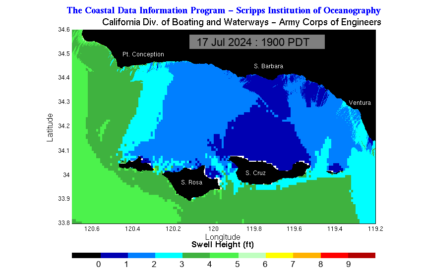
Offshore buoy, latest measurementno observed readingNext estimated breaking face1-2 ft @ 13.3 s · Wed, Oct 21, 9:00 AM
Estimated Breaking Face, Not Offshore Wave Height
No exact beach-reported face heights in the latest reports. Hovering an estimated-face point states the period of the sample that height was modeled from. The report form does not collect a wave period, so a crowd report's height says the period was not reported rather than borrowing the forecast's.
Swell from
270° W forecast
Offshore height
unknown observed and forecast span 1.3 to 2.8 ft
Dominant period
unknown
Beach faces
195° SSW dashed on compass
Offshore Wave Height, Observed And Forecast
Dominant Period, Observed And Forecast
Solid left of NOW: buoy measurements. Dashed right of NOW: wave-model forecast. Offshore significant wave height, not breaking face.
PZZ650 · East Santa Barbara Channel / CAZ349–350 · Santa Barbara south coast. Regional coverage, not every notice applies to this beach; read each notice’s area.
Small Craft AdvisorySmall Craft Advisory issued October 20 at 10:48PM PDT until October 21 at 8:00PM PDT by NWS Los Angeles/Oxnard CA
East Santa Barbara Channel from Pt. Conception to Pt. Mugu CA including Santa Cruz Island; Inner waters from Point Mugu to San Mateo Pt. CA including Santa Catalina and Anacapa Islands
Effective Expires
* WHAT...Hazardous sea conditions.
* WHERE...East Santa Barbara Channel from Pt. Conception to Pt.
Mugu CA including Santa Cruz Island and Inner waters from
Point Mugu to San Mateo Pt. CA including Santa Catalina and
Anacapa Islands.
* WHEN...From 11 AM to 8 PM PDT Wednesday.
* IMPACTS...Conditions will be hazardous to small craft.
* ADDITIONAL DETAILS...See the Coastal Waters Forecast (CWFLOX)
for more.
NWS instruction: Inexperienced mariners, especially those operating smaller
vessels, should avoid navigating in hazardous conditions.
Original alert ↗Marine Weather StatementMarine Weather Statement issued October 20 at 12:52PM PDT by NWS Los Angeles/Oxnard CA
Point Piedras Blancas to Point Sal westward out to 10 NM; East Santa Barbara Channel from Pt. Conception to Pt. Mugu CA including Santa Cruz Island; Inner waters from Point Mugu to San Mateo Pt. CA including Santa Catalina and Anacapa Islands; Point Piedras Blancas to Point Sal from 10 to 60 NM; Waters from Pt. Sal to Santa Cruz Island CA and westward 60 nm including San Miguel and Santa Rosa Islands; Outer waters from Santa Cruz Island to San Clemente Island to 60 NM offshore including San Nicolas and Santa Barbara Islands
Effective Expires
A moderate storm system will impact our coastal waters tonight through
Thursday, bringing a chance of thunderstorms to the area. Thunderstorm
activity is likely to be most hazardous for the waters south and
east of Point Conception with peak timing expected Wednesday
afternoon through Thursday morning.
Any thunderstorm that forms will be capable of producing local
gusts up to gale force, rough seas, dangerous lightning, heavy
rainfall with reduced visibility, and waterspouts.
Original alert ↗Flood WatchFlood Watch issued October 20 at 12:11PM PDT until October 22 at 4:00PM PDT by NWS Los Angeles/Oxnard CA
Santa Ynez Valley; Santa Barbara County Southwestern Coast; Santa Barbara County Southeastern Coast; Santa Ynez Mountains Western Range; Santa Ynez Mountains Eastern Range; Santa Barbara County Interior Mountains
Effective Expires
* WHAT...Flooding caused by excessive rainfall is possible.
* WHERE...A portion of southwest California, including the following
areas, Santa Barbara County Interior Mountains, Santa Barbara
County Southeastern Coast, Santa Barbara County Southwestern Coast,
Santa Ynez Mountains Eastern Range, Santa Ynez Mountains Western
Range and Santa Ynez Valley.
* WHEN...From Wednesday morning through Thursday afternoon.
* IMPACTS...Flooding may occur in poor drainage and urban areas.
Extensive street flooding and flooding of creeks and rivers are
possible.
* ADDITIONAL DETAILS...
- Rain rates between 0.50 and 1.00 inch per hour are possible,
heaviest Wednesday into Wednesday night.
- http://www.weather.gov/safety/flood
NWS instruction: You should monitor later forecasts and be alert for possible Flood
Warnings. Those living in areas prone to flooding should be prepared
to take action should flooding develop.
.TONIGHT: SW wind 5 to 10 kt, becoming SE after midnight. Seas
2 to 3 ft. Wave Detail: W 2 ft at 10 seconds and S 2 ft at
15 seconds. A slight chance of showers late this evening. A chance
of showers after midnight.
Regional wind and sea state—not breaking surf at an individual beach.
Read PZZ650 forecast
PZZ650-211630-
East Santa Barbara Channel from Pt. Conception to Pt. Mugu CA
including Santa Cruz Island-
908 PM PDT Tue Oct 20 2026
...SMALL CRAFT ADVISORY IN EFFECT FROM WEDNESDAY MORNING THROUGH
WEDNESDAY EVENING...
.TONIGHT: SW wind 5 to 10 kt, becoming SE after midnight. Seas
2 to 3 ft. Wave Detail: W 2 ft at 10 seconds and S 2 ft at
15 seconds. A slight chance of showers late this evening. A chance
of showers after midnight.
.WED: SE wind 10 to 15 kt, becoming 15 to 25 kt in the afternoon.
Seas 2 to 4 ft. Wave Detail: SE 3 ft at 5 seconds and W 2 ft at
13 seconds. Showers with a slight chance of tstms.
.WED NIGHT: E wind 10 to 20 kt. Gusts to 25 kt in the evening.
Seas 3 to 5 ft. Wave Detail: SE 3 ft at 5 seconds, W 2 ft at 12
seconds and S 2 ft at 14 seconds. Rain with a slight chance of
tstms.
.THU: Light winds, becoming NW 10 to 20 kt in the afternoon. Seas
2 to 3 ft. Wave Detail: NW 2 ft at 4 seconds, W 2 ft at 11 seconds
and S 2 ft at 15 seconds. A slight chance of tstms. Rain.
.THU NIGHT: W wind 10 to 20 kt, becoming NW 15 to 25 kt after
midnight. Seas 2 to 4 ft. Wave Detail: W 3 ft at 5 seconds.
.FRI: Western Portion, NW wind 15 to 20 kt. Eastern Portion, NW
wind 5 to 10 kt. Seas 2 to 4 ft. Wave Detail: NW 3 ft at 7 seconds
and W 2 ft at 8 seconds.
.FRI NIGHT: NW wind 20 to 30 kt, becoming N 10 to 15 kt after
midnight. Seas 4 to 6 ft, subsiding to 3 to 4 ft. Wave Detail: NW
5 ft at 7 seconds.
.SAT: Light winds. Seas 2 to 3 ft. Wave Detail: W 3 ft at
9 seconds.
.SAT NIGHT: NW wind 5 to 10 kt. Seas 2 to 3 ft. Wave Detail: NW
2 ft at 5 seconds and W 2 ft at 11 seconds.
.SUN: NE wind 5 to 10 kt in the morning, becoming light. Seas
2 ft. Wave Detail: W 2 ft at 5 seconds.
.SUN NIGHT: NW wind 5 to 10 kt. Seas 2 to 3 ft. Wave Detail: NW
2 ft at 5 seconds.
Winds and seas higher in and near tstms.
Original bulletin · all LOX zones
000
FZUS56 KLOX 210408
CWFLOX

Coastal Waters Forecast for California
National Weather Service Los Angeles/Oxnard CA
908 PM PDT Tue Oct 20 2026

Point Piedras Blancas to San Mateo Point CA out 60 NM including the
Channel Islands National Marine Sanctuary.

PZZ600-211630-
908 PM PDT Tue Oct 20 2026

.Synopsis for the southern California coast and Santa Barbara
Channel including the Channel Islands National Marine Sanctuary
and National Park...At 03Z or 8 PM PDT, there was a 1007 mb low was
550 NM W of Los Angeles CA. This low and associated cold front will
impact our coastal waters late tonight through Thursday, bringing the
potential for heavy showers, thunderstorms, and possible
waterspouts.

$$

PZZ645-211630-
Point Piedras Blancas to Point Sal westward out to 10 NM-
908 PM PDT Tue Oct 20 2026

.TONIGHT...Light winds, becoming SE 5 to 10 kt after midnight. Seas
5 to 7 ft. Wave Detail: NW 6 ft at 13 seconds and S 3 ft at
15 seconds. A chance of showers late this evening. Showers likely
after midnight.
.WED...SE wind 10 to 15 kt. Seas 5 to 7 ft. Wave Detail: S 4 ft at
6 seconds, NW 5 ft at 12 seconds and S 3 ft at 14 seconds. Showers
with a slight chance of tstms.
.WED NIGHT...SE wind 5 to 10 kt, becoming NE 10 to 15 kt after
midnight. Seas 4 to 6 ft. Wave Detail: S 3 ft at 5 seconds, W 4 ft
at 11 seconds and S 3 ft at 14 seconds. Rain with a slight chance
of tstms.
.THU...Light winds, becoming NW 10 to 20 kt in the afternoon. Seas
4 to 5 ft. Wave Detail: NW 2 ft at 5 seconds, W 3 ft at 10 seconds
and S 3 ft at 15 seconds. Rain.
.THU NIGHT...NW wind 15 to 25 kt. Seas 4 to 5 ft. Wave Detail: NW
4 ft at 6 seconds, NW 3 ft at 11 seconds and S 3 ft at 15 seconds.
A chance of showers in the evening.
.FRI...NW wind 10 to 20 kt. Seas 4 to 6 ft. Wave Detail: NW 5 ft at
8 seconds and S 3 ft at 16 seconds.
.FRI NIGHT...NW wind 15 to 25 kt, becoming N 10 to 15 kt after
midnight. Seas 5 to 7 ft. Wave Detail: NW 6 ft at 9 seconds and S
2 ft at 16 seconds.
.SAT...N wind 10 to 15 kt, becoming NW 5 to 10 kt in the afternoon.
Seas 4 to 6 ft. Wave Detail: NW 6 ft at 10 seconds and S 2 ft at
15 seconds.
.SAT NIGHT...NW wind 10 to 15 kt in the evening, becoming light.
Seas 4 to 5 ft. Wave Detail: NW 5 ft at 10 seconds and S 2 ft at
15 seconds.
.SUN...NE wind 5 to 10 kt in the morning, becoming light. Seas 3 to
4 ft. Wave Detail: NW 3 ft at 10 seconds and S 2 ft at 14 seconds.
.SUN NIGHT...NW wind 5 to 10 kt in the evening, becoming light.
Seas 3 to 4 ft. Wave Detail: NW 3 ft at 10 seconds and S 2 ft at
14 seconds.

Winds and seas higher in and near tstms.

$$

PZZ670-211630-
Point Piedras Blancas to Point Sal from 10 to 60 NM-
908 PM PDT Tue Oct 20 2026

.TONIGHT...Light winds, becoming SE 5 to 10 kt after midnight. Seas
7 to 9 ft. Wave Detail: NW 8 ft at 13 seconds and S 3 ft at
15 seconds. A chance of showers late this evening. Showers with a
slight chance of tstms after midnight.
.WED...SE wind 10 to 20 kt. Seas 7 to 8 ft. Wave Detail: SE 4 ft at
6 seconds, NW 7 ft at 12 seconds and S 3 ft at 14 seconds. Showers
with a slight chance of tstms.
.WED NIGHT...SE wind 5 to 10 kt, becoming N after midnight. Seas
5 to 6 ft. Wave Detail: SE 3 ft at 6 seconds, NW 4 ft at 11 seconds
and S 3 ft at 14 seconds. A slight chance of tstms in the evening.
Rain.
.THU...N wind 5 to 10 kt, becoming NW 10 to 15 kt in the afternoon.
Seas 5 ft. Wave Detail: NW 2 ft at 5 seconds, NW 4 ft at 10 seconds
and S 3 ft at 15 seconds. Rain in the morning, then a chance of
rain in the afternoon.
.THU NIGHT...NW wind 15 to 20 kt. Seas 5 to 6 ft. Wave Detail: NW
5 ft at 7 seconds, NW 3 ft at 11 seconds and S 3 ft at 15 seconds.
.FRI...NW wind 10 to 20 kt. Seas 6 to 7 ft. Wave Detail: NW 7 ft at
7 seconds, NW 2 ft at 13 seconds and S 3 ft at 15 seconds.
.FRI NIGHT...NW wind 15 to 20 kt, becoming N 10 to 20 kt after
midnight. Seas 7 to 8 ft. Wave Detail: NW 7 ft at 10 seconds and S
3 ft at 16 seconds.
.SAT...N wind 5 to 10 kt. Seas 6 to 8 ft. Wave Detail: NW 7 ft at
10 seconds and S 3 ft at 15 seconds.
.SAT NIGHT...NW wind 5 to 10 kt. Seas 5 to 6 ft. Wave Detail: NW
5 ft at 10 seconds and S 2 ft at 15 seconds.
.SUN...Light winds. Seas 4 to 5 ft. Wave Detail: NW 4 ft at
10 seconds and S 2 ft at 14 seconds.
.SUN NIGHT...NW wind 5 to 10 kt. Seas 4 ft. Wave Detail: NW 3 ft at
5 seconds, NW 3 ft at 10 seconds and S 2 ft at 14 seconds.

Winds and seas higher in and near tstms.

$$

PZZ673-211630-
Waters from Pt. Sal to Santa Cruz Island CA and westward 60 nm
including San Miguel and Santa Rosa Islands-
908 PM PDT Tue Oct 20 2026

...SMALL CRAFT ADVISORY IN EFFECT FROM 5 AM PDT WEDNESDAY THROUGH
WEDNESDAY AFTERNOON...

.TONIGHT...Light winds, becoming SE 5 to 10 kt after midnight. Seas
6 to 8 ft. Wave Detail: NW 8 ft at 13 seconds and S 4 ft at
15 seconds. A chance of showers late this evening. Showers likely
with a slight chance of tstms after midnight.
.WED...SE wind 15 to 25 kt. Seas 6 to 8 ft. Wave Detail: SE 5 ft at
6 seconds, NW 7 ft at 12 seconds and S 3 ft at 14 seconds. Showers
with a slight chance of tstms.
.WED NIGHT...S wind 10 to 20 kt, becoming NW 10 kt after midnight.
Seas 5 to 7 ft. Wave Detail: S 3 ft at 5 seconds, NW 5 ft at
11 seconds and S 3 ft at 14 seconds. Rain with a slight chance of
tstms.
.THU...NW wind 5 to 10 kt, becoming 10 to 20 kt in the afternoon.
Seas 4 to 6 ft. Wave Detail: NW 2 ft at 5 seconds, NW 4 ft at
10 seconds and S 3 ft at 15 seconds. Rain in the morning, then a
chance of rain in the afternoon.
.THU NIGHT...NW wind 15 to 20 kt, becoming 20 to 25 kt after
midnight. Seas 5 to 7 ft. Wave Detail: NW 6 ft at 7 seconds, NW
4 ft at 11 seconds and S 3 ft at 15 seconds. A slight chance of
showers.
.FRI...NW wind 20 to 25 kt. Seas 5 to 7 ft. Wave Detail: NW 7 ft at
8 seconds, NW 2 ft at 12 seconds and S 3 ft at 15 seconds.
.FRI NIGHT...NW wind 20 to 30 kt, becoming N 15 to 25 kt after
midnight. Seas 7 to 8 ft. Wave Detail: NW 7 ft at 9 seconds and S
3 ft at 16 seconds.
.SAT...N wind 10 to 20 kt, becoming 5 to 10 kt in the afternoon.
Seas 6 to 8 ft. Wave Detail: N 2 ft at 5 seconds, NW 7 ft at
10 seconds and S 3 ft at 15 seconds.
.SAT NIGHT...NW wind 5 to 10 kt. Seas 5 to 7 ft. Wave Detail: NW
6 ft at 10 seconds and S 2 ft at 15 seconds.
.SUN...N wind 5 to 10 kt in the morning, becoming light. Seas 4 to
5 ft. Wave Detail: N 2 ft at 5 seconds, NW 5 ft at 10 seconds and S
2 ft at 14 seconds.
.SUN NIGHT...NW wind 5 to 10 kt, becoming 10 to 15 kt after
midnight. Seas 4 ft. Wave Detail: NW 3 ft at 5 seconds, NW 4 ft at
10 seconds and S 2 ft at 14 seconds.

Winds and seas higher in and near tstms.

$$

PZZ676-211630-
Outer waters from Santa Cruz Island to San Clemente Island to 60 NM
offshore including San Nicolas and Santa Barbara Islands-
908 PM PDT Tue Oct 20 2026

.TONIGHT...SW wind 5 to 10 kt, becoming S after midnight. Seas 5 to
7 ft. Wave Detail: NW 5 ft at 11 seconds and S 3 ft at 15 seconds.
A slight chance of showers late this evening. A chance of showers
after midnight.
.WED...SE wind 10 to 20 kt. Seas 5 to 7 ft. Wave Detail: SE 3 ft at
5 seconds, NW 5 ft at 13 seconds and S 3 ft at 14 seconds. Showers
with a slight chance of tstms.
.WED NIGHT...S wind 10 to 15 kt, becoming W after midnight. Seas
5 to 7 ft. Wave Detail: S 3 ft at 5 seconds, NW 5 ft at 11 seconds
and S 3 ft at 14 seconds. A slight chance of tstms. Rain.
.THU...NW wind 5 to 10 kt, becoming 10 to 15 kt in the afternoon.
Seas 4 to 5 ft. Wave Detail: NW 2 ft at 5 seconds, W 4 ft at
11 seconds and S 3 ft at 15 seconds. A slight chance of tstms. Rain
in the morning, then a chance of rain in the afternoon.
.THU NIGHT...NW wind 15 to 25 kt. Seas 4 to 6 ft. Wave Detail: NW
6 ft at 6 seconds, W 3 ft at 11 seconds and S 3 ft at 15 seconds. A
slight chance of showers.
.FRI...NW wind 15 to 25 kt. Seas 5 to 7 ft. Wave Detail: NW 6 ft at
7 seconds and S 2 ft at 15 seconds.
.FRI NIGHT...NW wind 15 to 25 kt. Seas 6 to 8 ft. Wave Detail: NW
7 ft at 8 seconds and S 3 ft at 15 seconds.
.SAT...N wind 10 to 15 kt, becoming 5 to 10 kt in the afternoon.
Seas 5 to 7 ft. Wave Detail: NW 6 ft at 9 seconds and S 3 ft at
15 seconds.
.SAT NIGHT...NW wind 5 to 10 kt. Seas 4 to 6 ft. Wave Detail: NW
3 ft at 5 seconds, NW 4 ft at 10 seconds and S 2 ft at 15 seconds.
.SUN...N wind 5 to 10 kt in the morning, becoming light. Seas 3 to
5 ft. Wave Detail: NW 3 ft at 5 seconds, NW 4 ft at 10 seconds and
S 2 ft at 14 seconds.
.SUN NIGHT...NW wind 5 to 10 kt. Seas 3 to 5 ft. Wave Detail: NW
3 ft at 5 seconds, NW 3 ft at 10 seconds and S 2 ft at 14 seconds.

Winds and seas higher in and near tstms.

$$

PZZ650-211630-
East Santa Barbara Channel from Pt. Conception to Pt. Mugu CA
including Santa Cruz Island-
908 PM PDT Tue Oct 20 2026

...SMALL CRAFT ADVISORY IN EFFECT FROM WEDNESDAY MORNING THROUGH
WEDNESDAY EVENING...

.TONIGHT...SW wind 5 to 10 kt, becoming SE after midnight. Seas
2 to 3 ft. Wave Detail: W 2 ft at 10 seconds and S 2 ft at
15 seconds. A slight chance of showers late this evening. A chance
of showers after midnight.
.WED...SE wind 10 to 15 kt, becoming 15 to 25 kt in the afternoon.
Seas 2 to 4 ft. Wave Detail: SE 3 ft at 5 seconds and W 2 ft at
13 seconds. Showers with a slight chance of tstms.
.WED NIGHT...E wind 10 to 20 kt. Gusts to 25 kt in the evening.
Seas 3 to 5 ft. Wave Detail: SE 3 ft at 5 seconds, W 2 ft at 12
seconds and S 2 ft at 14 seconds. Rain with a slight chance of
tstms.
.THU...Light winds, becoming NW 10 to 20 kt in the afternoon. Seas
2 to 3 ft. Wave Detail: NW 2 ft at 4 seconds, W 2 ft at 11 seconds
and S 2 ft at 15 seconds. A slight chance of tstms. Rain.
.THU NIGHT...W wind 10 to 20 kt, becoming NW 15 to 25 kt after
midnight. Seas 2 to 4 ft. Wave Detail: W 3 ft at 5 seconds.
.FRI...Western Portion, NW wind 15 to 20 kt. Eastern Portion, NW
wind 5 to 10 kt. Seas 2 to 4 ft. Wave Detail: NW 3 ft at 7 seconds
and W 2 ft at 8 seconds.
.FRI NIGHT...NW wind 20 to 30 kt, becoming N 10 to 15 kt after
midnight. Seas 4 to 6 ft, subsiding to 3 to 4 ft. Wave Detail: NW
5 ft at 7 seconds.
.SAT...Light winds. Seas 2 to 3 ft. Wave Detail: W 3 ft at
9 seconds.
.SAT NIGHT...NW wind 5 to 10 kt. Seas 2 to 3 ft. Wave Detail: NW
2 ft at 5 seconds and W 2 ft at 11 seconds.
.SUN...NE wind 5 to 10 kt in the morning, becoming light. Seas
2 ft. Wave Detail: W 2 ft at 5 seconds.
.SUN NIGHT...NW wind 5 to 10 kt. Seas 2 to 3 ft. Wave Detail: NW
2 ft at 5 seconds.

Winds and seas higher in and near tstms.

$$

PZZ655-211630-
Inner waters from Point Mugu to San Mateo Pt. CA including Santa
Catalina and Anacapa Islands-
908 PM PDT Tue Oct 20 2026

...SMALL CRAFT ADVISORY IN EFFECT FROM WEDNESDAY MORNING THROUGH
WEDNESDAY EVENING...

.TONIGHT...SW wind 5 to 10 kt this evening, becoming light. Seas
3 to 4 ft. Wave Detail: W 3 ft at 10 seconds and S 3 ft at
15 seconds.
.WED...SE wind 5 to 10 kt, becoming S 10 to 20 kt in the afternoon.
Gusts to 25 kt. Seas 2 to 4 ft. Wave Detail: S 2 ft at 5 seconds, S
2 ft at 14 seconds and W 2 ft at 14 seconds. A chance of showers in
the morning, then showers likely with a slight chance of tstms in
the afternoon.
.WED NIGHT...S wind 10 to 20 kt. Gusts to 25 kt in the evening.
Seas 3 to 5 ft. Wave Detail: S 3 ft at 5 seconds, W 2 ft at 12
seconds and S 2 ft at 14 seconds. Rain with a slight chance of
tstms.
.THU...NW wind 5 to 10 kt, becoming W 10 to 15 kt in the afternoon.
Seas 3 to 4 ft. Wave Detail: W 2 ft at 5 seconds, W 2 ft at
11 seconds and S 3 ft at 15 seconds. Rain with a slight chance of
tstms.
.THU NIGHT...W wind 10 to 15 kt, becoming NW 10 to 20 kt after
midnight. Seas 3 to 4 ft. Wave Detail: W 3 ft at 6 seconds, W 2 ft
at 10 seconds and S 2 ft at 15 seconds. A chance of showers.
.FRI...NW wind 10 to 15 kt, becoming 5 to 10 kt in the afternoon.
Seas 3 to 4 ft. Wave Detail: NW 4 ft at 7 seconds and S 2 ft at
16 seconds.
.FRI NIGHT...NW wind 10 to 15 kt, becoming N 5 to 10 kt after
midnight. Seas 3 to 4 ft. Wave Detail: W 3 ft at 8 seconds and S
2 ft at 16 seconds.
.SAT...Light winds. Seas 2 to 4 ft. Wave Detail: W 3 ft at
8 seconds and S 2 ft at 15 seconds.
.SAT NIGHT...W wind 10 to 15 kt, becoming NW 10 to 20 kt after
midnight. Seas 2 to 3 ft. Wave Detail: NW 2 ft at 5 seconds, W 2 ft
at 10 seconds and S 2 ft at 15 seconds.
.SUN...NE wind 5 to 10 kt in the morning, becoming light. Seas 2 to
3 ft. Wave Detail: NW 2 ft at 5 seconds.
.SUN NIGHT...W wind 10 to 15 kt, becoming NW 10 to 20 kt after
midnight. Seas 2 to 3 ft. Wave Detail: W 2 ft at 5 seconds.

Winds and seas higher in and near tstms.

$$


www.weather.gov/losangeles
National Weather Service · LOX
Surf zone & rip currents
Latest retrieved
CAZ349 / CAZ350 · Santa Barbara south coast
Issued
.THIS AFTERNOON THROUGH WEDNESDAY...
Rip Current Risk*: Low.
Surf Height: 1 to 2 feet.
Thunderstorm Potential: Slight chance.
Water Temperature: 70 to 71 degrees.
Astronomical Tides: Low 0.6 feet (MLLW) 02:04 AM PDT.
High 4.5 feet (MLLW) 08:41 AM PDT.
Low 2.1 feet (MLLW) 02:23 PM PDT.
High 4.5 feet (MLLW) 08:06 PM PDT.
Remarks: None.
Regional beach guidance—not a beach observation or a guarantee of safe swimming.
Read Santa Barbara surf-zone forecast
CAZ349-350-211215-
Santa Barbara County Southwestern Coast-
Santa Barbara County Southeastern Coast-
204 PM PDT Tue Oct 20 2026
...MODERATE RIP CURRENT RISK...
...SLIGHT CHANCE OF THUNDERSTORMS: .
.THIS AFTERNOON THROUGH WEDNESDAY...
Rip Current Risk*: Low.
Surf Height: 1 to 2 feet.
Thunderstorm Potential: Slight chance.
Water Temperature: 70 to 71 degrees.
Astronomical Tides: Low 0.6 feet (MLLW) 02:04 AM PDT.
High 4.5 feet (MLLW) 08:41 AM PDT.
Low 2.1 feet (MLLW) 02:23 PM PDT.
High 4.5 feet (MLLW) 08:06 PM PDT.
Remarks: None.
.THURSDAY...
Rip Current Risk*: Moderate.
Surf Height: 2 to 3 feet.
Thunderstorm Potential: Slight chance.
Astronomical Tides: Low 0.6 feet (MLLW) 02:33 AM PDT.
High 4.8 feet (MLLW) 08:59 AM PDT.
Low 1.4 feet (MLLW) 03:00 PM PDT.
High 4.6 feet (MLLW) 08:53 PM PDT.
Remarks: Mixed south swell and west swell.
&&
Rip Current Risks:
* Low Risk - Life threatening rip currents are unlikely but still could occur.
* Moderate Risk - Life threatening rip currents are possible.
* High Risk - Life threatening rip currents are likely.
Original bulletin · all LOX zones
000
FZUS56 KLOX 202104
SRFLOX

Surf Zone Forecast
National Weather Service Los Angeles/Oxnard
204 PM PDT Tue Oct 20 2026

CAZ362-364-211215-
Malibu Coast-
Los Angeles County Beaches-
204 PM PDT Tue Oct 20 2026

...BEACH HAZARDS STATEMENT THROUGH 3 AM FRIDAY...
...HIGH RIP CURRENT RISK...
...SLIGHT CHANCE OF THUNDERSTORMS....

.THIS AFTERNOON THROUGH WEDNESDAY...
Rip Current Risk*.............High.
Surf Height...................3 to 5 feet.
Thunderstorm Potential........None expected.
Water Temperature.............70 to 73 degrees.
Astronomical Tides............Low 0.6 feet (MLLW) 01:47 AM PDT.
                              High 4.6 feet (MLLW) 08:25 AM PDT.
                              Low 2.1 feet (MLLW) 02:06 PM PDT.
                              High 4.7 feet (MLLW) 07:49 PM PDT.
Remarks.......................Mixed south swell and west swell.

.THURSDAY...
Rip Current Risk*.............High.
Surf Height...................3 to 6 feet.
Thunderstorm Potential........Slight chance.
Astronomical Tides............Low 0.6 feet (MLLW) 02:15 AM PDT.
                              High 5.0 feet (MLLW) 08:41 AM PDT.
                              Low 1.4 feet (MLLW) 02:41 PM PDT.
                              High 4.8 feet (MLLW) 08:33 PM PDT.
Remarks.......................Mixed south swell and west swell.


&&

Rip Current Risks:
* Low Risk - Life threatening rip currents are unlikely but still could occur.
* Moderate Risk - Life threatening rip currents are possible.
* High Risk - Life threatening rip currents are likely.

$$


CAZ354-211215-
Ventura County Beaches-
204 PM PDT Tue Oct 20 2026

...BEACH HAZARDS STATEMENT THROUGH 3 AM FRIDAY...
...MODERATE RIP CURRENT RISK...
...SLIGHT CHANCE OF THUNDERSTORMS....

.THIS AFTERNOON THROUGH WEDNESDAY...
Rip Current Risk*.............High.
Surf Height...................3 to 5 feet.
Thunderstorm Potential........Slight chance.
Water Temperature.............69 to 72 degrees.
Astronomical Tides............Low 0.6 feet (MLLW) 01:50 AM PDT.
                              High 4.5 feet (MLLW) 08:27 AM PDT.
                              Low 2.0 feet (MLLW) 02:08 PM PDT.
                              High 4.6 feet (MLLW) 07:51 PM PDT.
Remarks.......................South swell.

.THURSDAY...
Rip Current Risk*.............Moderate.
Surf Height...................3 to 5 feet.
Thunderstorm Potential........Slight chance.
Astronomical Tides............Low 0.6 feet (MLLW) 02:18 AM PDT.
                              High 4.9 feet (MLLW) 08:44 AM PDT.
                              Low 1.4 feet (MLLW) 02:43 PM PDT.
                              High 4.7 feet (MLLW) 08:36 PM PDT.
Remarks.......................Mixed south swell and west swell.


&&
Moderate
Rip Current Risks:
* Low Risk - Life threatening rip currents are unlikely but still could occur.
* Moderate Risk - Life threatening rip currents are possible.
* High Risk - Life threatening rip currents are likely.

$$


CAZ349-350-211215-
Santa Barbara County Southwestern Coast-
Santa Barbara County Southeastern Coast-
204 PM PDT Tue Oct 20 2026

...MODERATE RIP CURRENT RISK...
...SLIGHT CHANCE OF THUNDERSTORMS....

.THIS AFTERNOON THROUGH WEDNESDAY...
Rip Current Risk*.............Low.
Surf Height...................1 to 2 feet.
Thunderstorm Potential........Slight chance.
Water Temperature.............70 to 71 degrees.
Astronomical Tides............Low 0.6 feet (MLLW) 02:04 AM PDT.
                              High 4.5 feet (MLLW) 08:41 AM PDT.
                              Low 2.1 feet (MLLW) 02:23 PM PDT.
                              High 4.5 feet (MLLW) 08:06 PM PDT.
Remarks.......................None.

.THURSDAY...
Rip Current Risk*.............Moderate.
Surf Height...................2 to 3 feet.
Thunderstorm Potential........Slight chance.
Astronomical Tides............Low 0.6 feet (MLLW) 02:33 AM PDT.
                              High 4.8 feet (MLLW) 08:59 AM PDT.
                              Low 1.4 feet (MLLW) 03:00 PM PDT.
                              High 4.6 feet (MLLW) 08:53 PM PDT.
Remarks.......................Mixed south swell and west swell.


&&

Rip Current Risks:
* Low Risk - Life threatening rip currents are unlikely but still could occur.
* Moderate Risk - Life threatening rip currents are possible.
* High Risk - Life threatening rip currents are likely.

$$


CAZ340-346-211215-
San Luis Obispo County Beaches-
Santa Barbara Central Coast Beaches-
204 PM PDT Tue Oct 20 2026


...SLIGHT CHANCE OF THUNDERSTORMS....

.THIS AFTERNOON THROUGH WEDNESDAY...
Surf Height...................3 to 6 feet.
Thunderstorm Potential........Slight chance.
Water Temperature.............66 to 68 degrees.
Astronomical Tides............Low 0.6 feet (MLLW) 02:19 AM PDT7.
                              High 4.5 feet (MLLW) 09:02 AM PDT.
                              Low 2.2 feet (MLLW) 02:45 PM PDT.
                              High 4.4 feet (MLLW) 08:23 PM PDT.
Remarks.......................Mixed west swell and south swell.

.THURSDAY...
Surf Height...................4 to 8 feet.
Thunderstorm Potential........None expected.
Astronomical Tides............Low 0.7 feet (MLLW) 02:50 AM PDT.
                              High 4.8 feet (MLLW) 09:21 AM PDT.
                              Low 1.6 feet (MLLW) 03:24 PM PDT.
                              High 4.5 feet (MLLW) 09:13 PM PDT.
Remarks.......................Mixed west swell and south swell.


&&

Rip Current Risks:
* Low Risk - Life threatening rip currents are unlikely but still could occur.
* Moderate Risk - Life threatening rip currents are possible.
* High Risk - Life threatening rip currents are likely.

$$
Web pages and internet audio are not a replacement for official warning channels or a weather radio.
NWS responses are cached across viewers; images load directly from CDIP using the provider’s browser-cache policy. The source analysis time remains on the original map.
Community evidence
Tar & Oil Conditions
Scores summarize recent beach reports, not a water-quality test. No reports means unknown, not clean.
Nothing to plot: no field reports have been scored for this beach in this window. An empty 0-10 lane would look the same as a clean beach, so none is drawn.
Arrows point the way the wind is heading; the reading is the bearing it comes from, 0° = north.
TodayUV 5 ModerateSunrise 7:09 AMSunset 6:16 PMMoonrise 3:49 PMMoonset 2:27 AM Waxing Gibbousapprox. next full moon Oct 27
Weather sources & timestamps3 sources
WeatherOpen-Meteo Forecast API
Requested at 34.4198, -119.6016
Valid for
the time this forecast or prediction describes, not when it was made
Successful fetch
recorded time for the last accepted fetch; not proof the value changed (see source timing details below)
Modeled hourly weather for this beach's coordinates, not a reading from an instrument at the beach. The upstream model issue time was not recorded with these data, so issuance is unknown.
recorded time for the last accepted fetch; not proof the value changed (see source timing details below)
One instrument's own reading, selected independently of the wave station. The fetch timestamp records the start of a successful poll of this field's provider and product, not response completion or the age of the reading.
SunCalc computes sun and moon rise/set times from the Pacific date and beach coordinates, assuming an unobstructed horizon. Moon phase depends on date and time, not the beach location. No feed or beach sensor is involved; terrain and atmospheric conditions affect visible rise/set times. Sunrise, sunset, moonrise, moonset and phase are calculated per Pacific calendar day for 7 days from this one.
All times are Pacific. An upstream issue time is shown only when recorded. A feed response time is not the provider's model initialization or publication time. Unlisted timestamps were not recorded or do not apply.
Water reference: East Santa Barbara · 46053 . Latest prior accepted buoy measurement at each hour, at most three hours old—not a shoreline thermometer or a water-temperature forecast.
Nearby stations and configured reference sites with current usable readings. Measurements describe conditions at the instrument, not breaking surf on this beach. The map includes the wider station catalog.
West Santa Barbara
NDBC 46054
Reporting
Moored buoy · 81.2 km from this beach · 454 m depth
last observation Oct 20, 2026, 11:30 PM
Significant wave height
4.9 ftobserved Oct 20, 2026, 11:20 PM · NDBC 46054
Dominant period
14.0 sobserved Oct 20, 2026, 11:20 PM · NDBC 46054
69.8 °Fobserved Oct 20, 2026, 11:30 PM · NDBC 46054
Wind
7.8 ktobserved Oct 20, 2026, 11:30 PM · NDBC 46054
Gust
11.7 ktobserved Oct 20, 2026, 11:30 PM · NDBC 46054
Wind direction
S 180° observed Oct 20, 2026, 11:30 PM · NDBC 46054
Air temperature
–°Fnot in the latest transmission
Significant wave height is the total measured sea state at this mooring, not the height breaking at
this beach. The modeled breaking estimate is on the Surf tab.
No accepted directional spectrum from the past 90 minutes is available, so no partitions are shown.
Station sources & timestamps3 sources
Latest station reportNDBC, NOAA
West Santa Barbara (46054)
Observed
when the instrument took this reading
Successful fetch
recorded time for the last accepted fetch; not proof the value changed (see source timing details below)
Latest report received from this physical station; individual fields can have older observation times. This is the recorded start of the most recent successful live poll across this station's products, not response completion or proof that every field refreshed.
recorded time for the last accepted fetch; not proof the value changed (see source timing details below)
One instrument's own reading of open water, selected independently of the water temperature station. The observation time is the oldest of the wave fields shown, so it can overstate a single field's age but never understate it. The fetch timestamp records the start of a successful poll of this field's provider and product, not response completion or the age of the reading.
recorded time for the last accepted fetch; not proof the value changed (see source timing details below)
One instrument's own reading, selected independently of the wave station. The fetch timestamp records the start of a successful poll of this field's provider and product, not response completion or the age of the reading.
All times are Pacific. An upstream issue time is shown only when recorded. A feed response time is not the provider's model initialization or publication time. Unlisted timestamps were not recorded or do not apply.
65.8 °Fobserved Oct 20, 2026, 11:30 PM · NDBC 46053
Significant wave height is the total measured sea state at this mooring, not the height breaking at
this beach. The modeled breaking estimate is on the Surf tab.
No accepted directional spectrum from the past 90 minutes is available, so no partitions are shown.
Station sources & timestamps3 sources
Latest station reportNDBC, NOAA
East Santa Barbara (46053)
Observed
when the instrument took this reading
Successful fetch
recorded time for the last accepted fetch; not proof the value changed (see source timing details below)
Latest report received from this physical station; individual fields can have older observation times. This is the recorded start of the most recent successful live poll across this station's products, not response completion or proof that every field refreshed.
recorded time for the last accepted fetch; not proof the value changed (see source timing details below)
One instrument's own reading of open water, selected independently of the water temperature station. The observation time is the oldest of the wave fields shown, so it can overstate a single field's age but never understate it. The fetch timestamp records the start of a successful poll of this field's provider and product, not response completion or the age of the reading.
recorded time for the last accepted fetch; not proof the value changed (see source timing details below)
One instrument's own reading, selected independently of the wave station. The fetch timestamp records the start of a successful poll of this field's provider and product, not response completion or the age of the reading.
All times are Pacific. An upstream issue time is shown only when recorded. A feed response time is not the provider's model initialization or publication time. Unlisted timestamps were not recorded or do not apply.
Moored buoy · 72.5 km from this beach · 1890 m depth
last observation Oct 20, 2026, 11:50 PM
Significant wave height
3.6 ftobserved Oct 20, 2026, 11:30 PM · CDIP 203
Dominant period
15.4 sobserved Oct 20, 2026, 11:30 PM · CDIP 203
Average period
9.9 sobserved Oct 20, 2026, 11:30 PM · CDIP 203
Mean wave direction
S 181° observed Oct 20, 2026, 11:30 PM · CDIP 203
Water temperature
71.8 °Fobserved Oct 20, 2026, 11:50 PM · CDIP 203
Wind
–ktnot in the latest transmission
Gust
–ktnot in the latest transmission
Wind direction
–not in the latest transmission
Air temperature
65.5 °Fobserved Oct 20, 2026, 11:26 PM · NDBC 46251
Significant wave height is the total measured sea state at this mooring, not the height breaking at
this beach. The modeled breaking estimate is on the Surf tab.
Partitions, computed hereWhere these partitions come from
Tarline splits this station's own directional wave spectrum into a swell part and a wind sea part.
The split is this site's computation, not a provider product, and it is deliberately conservative:
two parts, not a list of named swell trains. Variances add and heights do not, so the combined
figure below is 4 times the square root of the total variance rather than a sum of the partition
heights.
Swell 3.7 ft @ 15.4s energy period 12.0 s from SW 220°
Partitions combine to 3.7 ft significant height , against 3.6 ft measured at the station. Spectrum sampled Oct 20, 11:30 PM.
Station sources & timestamps4 sources
Latest station reportNDBC, NOAA
Santa Cruz Basin (46251)
Observed
when the instrument took this reading
Successful fetch
recorded time for the last accepted fetch; not proof the value changed (see source timing details below)
Latest report received from this physical station; individual fields can have older observation times. This is the recorded start of the most recent successful live poll across this station's products, not response completion or proof that every field refreshed.
Offshore swellCDIP, Scripps Institution of Oceanography
Santa Cruz Basin (46251)
Observed
when the instrument took this reading
Successful fetch
recorded time for the last accepted fetch; not proof the value changed (see source timing details below)
One instrument's own reading of open water, selected independently of the water temperature station. The observation time is the oldest of the wave fields shown, so it can overstate a single field's age but never understate it. Read through CDIP, Scripps Institution of Oceanography as 203. The fetch timestamp records the start of a successful poll of this field's provider and product, not response completion or the age of the reading.
Water temperatureCDIP, Scripps Institution of Oceanography
Santa Cruz Basin (46251)
Observed
when the instrument took this reading
Successful fetch
recorded time for the last accepted fetch; not proof the value changed (see source timing details below)
One instrument's own reading, selected independently of the wave station. Read through CDIP, Scripps Institution of Oceanography as 203. The fetch timestamp records the start of a successful poll of this field's provider and product, not response completion or the age of the reading.
Directional wave spectrumCDIP, Scripps Institution of Oceanography
Santa Cruz Basin (46251)
Observed
when the instrument took this reading
Successful fetch
recorded time for the last accepted fetch; not proof the value changed (see source timing details below)
Wave systems are partitioned from this measured spectrum. The fetch timestamp records the start of a successful poll of this provider's spectral product, not response completion. Spectra are retained for 72 hours.
All times are Pacific. An upstream issue time is shown only when recorded. A feed response time is not the provider's model initialization or publication time. Unlisted timestamps were not recorded or do not apply.
70.7 °Fobserved Oct 20, 2026, 11:20 PM · NDBC 46025
Wind
3.9 ktobserved Oct 20, 2026, 11:20 PM · NDBC 46025
Gust
5.8 ktobserved Oct 20, 2026, 11:20 PM · NDBC 46025
Wind direction
W 270° observed Oct 20, 2026, 11:20 PM · NDBC 46025
Air temperature
67.1 °Fobserved Oct 20, 2026, 11:20 PM · NDBC 46025
Significant wave height is the total measured sea state at this mooring, not the height breaking at
this beach. The modeled breaking estimate is on the Surf tab.
No accepted directional spectrum from the past 90 minutes is available, so no partitions are shown.
Station sources & timestamps3 sources
Latest station reportNDBC, NOAA
Santa Monica Basin (46025)
Observed
when the instrument took this reading
Successful fetch
recorded time for the last accepted fetch; not proof the value changed (see source timing details below)
Latest report received from this physical station; individual fields can have older observation times. This is the recorded start of the most recent successful live poll across this station's products, not response completion or proof that every field refreshed.
recorded time for the last accepted fetch; not proof the value changed (see source timing details below)
One instrument's own reading of open water, selected independently of the water temperature station. The observation time is the oldest of the wave fields shown, so it can overstate a single field's age but never understate it. The fetch timestamp records the start of a successful poll of this field's provider and product, not response completion or the age of the reading.
recorded time for the last accepted fetch; not proof the value changed (see source timing details below)
One instrument's own reading, selected independently of the wave station. The fetch timestamp records the start of a successful poll of this field's provider and product, not response completion or the age of the reading.
All times are Pacific. An upstream issue time is shown only when recorded. A feed response time is not the provider's model initialization or publication time. Unlisted timestamps were not recorded or do not apply.
70.3 °Fobserved Oct 20, 2026, 11:30 PM · NDBC 46069
Wind
3.9 ktobserved Oct 20, 2026, 11:30 PM · NDBC 46069
Gust
7.8 ktobserved Oct 20, 2026, 11:30 PM · NDBC 46069
Wind direction
W 260° observed Oct 20, 2026, 11:30 PM · NDBC 46069
Air temperature
64.6 °Fobserved Oct 20, 2026, 11:30 PM · NDBC 46069
Significant wave height is the total measured sea state at this mooring, not the height breaking at
this beach. The modeled breaking estimate is on the Surf tab.
No accepted directional spectrum from the past 90 minutes is available, so no partitions are shown.
Station sources & timestamps3 sources
Latest station reportNDBC, NOAA
South Santa Rosa (46069)
Observed
when the instrument took this reading
Successful fetch
recorded time for the last accepted fetch; not proof the value changed (see source timing details below)
Latest report received from this physical station; individual fields can have older observation times. This is the recorded start of the most recent successful live poll across this station's products, not response completion or proof that every field refreshed.
recorded time for the last accepted fetch; not proof the value changed (see source timing details below)
One instrument's own reading of open water, selected independently of the water temperature station. The observation time is the oldest of the wave fields shown, so it can overstate a single field's age but never understate it. The fetch timestamp records the start of a successful poll of this field's provider and product, not response completion or the age of the reading.
recorded time for the last accepted fetch; not proof the value changed (see source timing details below)
One instrument's own reading, selected independently of the wave station. The fetch timestamp records the start of a successful poll of this field's provider and product, not response completion or the age of the reading.
All times are Pacific. An upstream issue time is shown only when recorded. A feed response time is not the provider's model initialization or publication time. Unlisted timestamps were not recorded or do not apply.
–fttoo old to show, last reported Oct 20, 2026, 10:00 PM · NDBC 46268
Dominant period
–stoo old to show, last reported Oct 20, 2026, 10:00 PM · NDBC 46268
Average period
–stoo old to show, last reported Oct 20, 2026, 10:00 PM · NDBC 46268
Mean wave direction
–too old to show, last reported Oct 20, 2026, 10:00 PM · NDBC 46268
Water temperature
71.8 °Fobserved Oct 20, 2026, 10:15 PM · CDIP 103
Wind
–ktnot in the latest transmission
Gust
–ktnot in the latest transmission
Wind direction
–not in the latest transmission
Air temperature
–°Fnot in the latest transmission
Significant wave height is the total measured sea state at this mooring, not the height breaking at
this beach. The modeled breaking estimate is on the Surf tab.
No accepted directional spectrum from the past 90 minutes is available, so no partitions are shown.
Station sources & timestamps3 sources
Latest station reportNDBC, NOAA
Topanga Nearshore (46268)
Observed
when the instrument took this reading
Successful fetch
recorded time for the last accepted fetch; not proof the value changed (see source timing details below)
Latest report received from this physical station; individual fields can have older observation times. This is the recorded start of the most recent successful live poll across this station's products, not response completion or proof that every field refreshed.
recorded time for the last accepted fetch; not proof the value changed (see source timing details below)
One instrument's own reading of open water, selected independently of the water temperature station. The observation time is the oldest of the wave fields shown, so it can overstate a single field's age but never understate it. No accepted reading from this station is on record for the window shown. The fetch timestamp records the start of a successful poll of this field's provider and product, not response completion or the age of the reading.
Water temperatureCDIP, Scripps Institution of Oceanography
Topanga Nearshore (46268)
Observed
when the instrument took this reading
Successful fetch
recorded time for the last accepted fetch; not proof the value changed (see source timing details below)
One instrument's own reading, selected independently of the wave station. Read through CDIP, Scripps Institution of Oceanography as 103. The fetch timestamp records the start of a successful poll of this field's provider and product, not response completion or the age of the reading.
All times are Pacific. An upstream issue time is shown only when recorded. A feed response time is not the provider's model initialization or publication time. Unlisted timestamps were not recorded or do not apply.
Significant wave height is the total measured sea state at this mooring, not the height breaking at
this beach. The modeled breaking estimate is on the Surf tab.
Partitions, computed hereWhere these partitions come from
Tarline splits this station's own directional wave spectrum into a swell part and a wind sea part.
The split is this site's computation, not a provider product, and it is deliberately conservative:
two parts, not a list of named swell trains. Variances add and heights do not, so the combined
figure below is 4 times the square root of the total variance rather than a sum of the partition
heights.
Swell 2.9 ft @ 14.3s energy period 12.8 s from SW 220°
Wind sea 1.3 ft @ 4.5s energy period 3.8 s from W 270°
Wind sea 0.5 ft @ 2.3s energy period 2.1 s from W 277°
Partitions combine to 3.3 ft significant height , against 3.3 ft measured at the station. Spectrum sampled Oct 20, 11:30 PM.
Station sources & timestamps4 sources
Latest station reportNDBC, NOAA
Santa Monica Bay (46221)
Observed
when the instrument took this reading
Successful fetch
recorded time for the last accepted fetch; not proof the value changed (see source timing details below)
Latest report received from this physical station; individual fields can have older observation times. This is the recorded start of the most recent successful live poll across this station's products, not response completion or proof that every field refreshed.
Offshore swellCDIP, Scripps Institution of Oceanography
Santa Monica Bay (46221)
Observed
when the instrument took this reading
Successful fetch
recorded time for the last accepted fetch; not proof the value changed (see source timing details below)
One instrument's own reading of open water, selected independently of the water temperature station. The observation time is the oldest of the wave fields shown, so it can overstate a single field's age but never understate it. Read through CDIP, Scripps Institution of Oceanography as 028. The fetch timestamp records the start of a successful poll of this field's provider and product, not response completion or the age of the reading.
Water temperatureCDIP, Scripps Institution of Oceanography
Santa Monica Bay (46221)
Observed
when the instrument took this reading
Successful fetch
recorded time for the last accepted fetch; not proof the value changed (see source timing details below)
One instrument's own reading, selected independently of the wave station. Read through CDIP, Scripps Institution of Oceanography as 028. The fetch timestamp records the start of a successful poll of this field's provider and product, not response completion or the age of the reading.
Directional wave spectrumCDIP, Scripps Institution of Oceanography
Santa Monica Bay (46221)
Observed
when the instrument took this reading
Successful fetch
recorded time for the last accepted fetch; not proof the value changed (see source timing details below)
Wave systems are partitioned from this measured spectrum. The fetch timestamp records the start of a successful poll of this provider's spectral product, not response completion. Spectra are retained for 72 hours.
All times are Pacific. An upstream issue time is shown only when recorded. A feed response time is not the provider's model initialization or publication time. Unlisted timestamps were not recorded or do not apply.
65.3 °Fobserved Oct 20, 2026, 10:56 PM · NDBC 46218
Significant wave height is the total measured sea state at this mooring, not the height breaking at
this beach. The modeled breaking estimate is on the Surf tab.
Partitions, computed hereWhere these partitions come from
Tarline splits this station's own directional wave spectrum into a swell part and a wind sea part.
The split is this site's computation, not a provider product, and it is deliberately conservative:
two parts, not a list of named swell trains. Variances add and heights do not, so the combined
figure below is 4 times the square root of the total variance rather than a sum of the partition
heights.
Swell 6.0 ft @ 13.3s energy period 12.5 s from WNW 296°
Partitions combine to 6 ft significant height , against 6.0 ft measured at the station. Spectrum sampled Oct 20, 11:30 PM.
Station sources & timestamps4 sources
Latest station reportCDIP, Scripps Institution of Oceanography
Harvest (071)
Observed
when the instrument took this reading
Successful fetch
recorded time for the last accepted fetch; not proof the value changed (see source timing details below)
Latest report received from this physical station; individual fields can have older observation times. This is the recorded start of the most recent successful live poll across this station's products, not response completion or proof that every field refreshed.
Offshore swellCDIP, Scripps Institution of Oceanography
Harvest (071)
Observed
when the instrument took this reading
Successful fetch
recorded time for the last accepted fetch; not proof the value changed (see source timing details below)
One instrument's own reading of open water, selected independently of the water temperature station. The observation time is the oldest of the wave fields shown, so it can overstate a single field's age but never understate it. The fetch timestamp records the start of a successful poll of this field's provider and product, not response completion or the age of the reading.
Water temperatureCDIP, Scripps Institution of Oceanography
Harvest (071)
Observed
when the instrument took this reading
Successful fetch
recorded time for the last accepted fetch; not proof the value changed (see source timing details below)
One instrument's own reading, selected independently of the wave station. The fetch timestamp records the start of a successful poll of this field's provider and product, not response completion or the age of the reading.
Directional wave spectrumCDIP, Scripps Institution of Oceanography
Harvest (071)
Observed
when the instrument took this reading
Successful fetch
recorded time for the last accepted fetch; not proof the value changed (see source timing details below)
Wave systems are partitioned from this measured spectrum. The fetch timestamp records the start of a successful poll of this provider's spectral product, not response completion. Spectra are retained for 72 hours.
All times are Pacific. An upstream issue time is shown only when recorded. A feed response time is not the provider's model initialization or publication time. Unlisted timestamps were not recorded or do not apply.
Significant wave height is the total measured sea state at this mooring, not the height breaking at
this beach. The modeled breaking estimate is on the Surf tab.
Partitions, computed hereWhere these partitions come from
Tarline splits this station's own directional wave spectrum into a swell part and a wind sea part.
The split is this site's computation, not a provider product, and it is deliberately conservative:
two parts, not a list of named swell trains. Variances add and heights do not, so the combined
figure below is 4 times the square root of the total variance rather than a sum of the partition
heights.
Swell 2.7 ft @ 13.3s energy period 12.9 s from SSW 207°
Partitions combine to 2.7 ft significant height , against 2.7 ft measured at the station. Spectrum sampled Oct 20, 11:30 PM.
Station sources & timestamps4 sources
Latest station reportCDIP, Scripps Institution of Oceanography
Avila Beach Nearshore (285)
Observed
when the instrument took this reading
Successful fetch
recorded time for the last accepted fetch; not proof the value changed (see source timing details below)
Latest report received from this physical station; individual fields can have older observation times. This is the recorded start of the most recent successful live poll across this station's products, not response completion or proof that every field refreshed.
Offshore swellCDIP, Scripps Institution of Oceanography
Avila Beach Nearshore (285)
Observed
when the instrument took this reading
Successful fetch
recorded time for the last accepted fetch; not proof the value changed (see source timing details below)
One instrument's own reading of open water, selected independently of the water temperature station. The observation time is the oldest of the wave fields shown, so it can overstate a single field's age but never understate it. The fetch timestamp records the start of a successful poll of this field's provider and product, not response completion or the age of the reading.
Water temperatureCDIP, Scripps Institution of Oceanography
Avila Beach Nearshore (285)
Observed
when the instrument took this reading
Successful fetch
recorded time for the last accepted fetch; not proof the value changed (see source timing details below)
One instrument's own reading, selected independently of the wave station. The fetch timestamp records the start of a successful poll of this field's provider and product, not response completion or the age of the reading.
Directional wave spectrumCDIP, Scripps Institution of Oceanography
Avila Beach Nearshore (285)
Observed
when the instrument took this reading
Successful fetch
recorded time for the last accepted fetch; not proof the value changed (see source timing details below)
Wave systems are partitioned from this measured spectrum. The fetch timestamp records the start of a successful poll of this provider's spectral product, not response completion. Spectra are retained for 72 hours.
All times are Pacific. An upstream issue time is shown only when recorded. A feed response time is not the provider's model initialization or publication time. Unlisted timestamps were not recorded or do not apply.
Significant wave height is the total measured sea state at this mooring, not the height breaking at
this beach. The modeled breaking estimate is on the Surf tab.
Partitions, computed hereWhere these partitions come from
Tarline splits this station's own directional wave spectrum into a swell part and a wind sea part.
The split is this site's computation, not a provider product, and it is deliberately conservative:
two parts, not a list of named swell trains. Variances add and heights do not, so the combined
figure below is 4 times the square root of the total variance rather than a sum of the partition
heights.
Swell 2.7 ft @ 13.3s energy period 12.9 s from SSW 207°
Partitions combine to 2.7 ft significant height , against 2.7 ft measured at the station. Spectrum sampled Oct 20, 11:30 PM.
Station sources & timestamps4 sources
Latest station reportNDBC, NOAA
Avila Beach Nearshore (46286)
Observed
when the instrument took this reading
Successful fetch
recorded time for the last accepted fetch; not proof the value changed (see source timing details below)
Latest report received from this physical station; individual fields can have older observation times. This is the recorded start of the most recent successful live poll across this station's products, not response completion or proof that every field refreshed.
Offshore swellCDIP, Scripps Institution of Oceanography
Avila Beach Nearshore (46286)
Observed
when the instrument took this reading
Successful fetch
recorded time for the last accepted fetch; not proof the value changed (see source timing details below)
One instrument's own reading of open water, selected independently of the water temperature station. The observation time is the oldest of the wave fields shown, so it can overstate a single field's age but never understate it. Read through CDIP, Scripps Institution of Oceanography as 285. The fetch timestamp records the start of a successful poll of this field's provider and product, not response completion or the age of the reading.
Water temperatureCDIP, Scripps Institution of Oceanography
Avila Beach Nearshore (46286)
Observed
when the instrument took this reading
Successful fetch
recorded time for the last accepted fetch; not proof the value changed (see source timing details below)
One instrument's own reading, selected independently of the wave station. Read through CDIP, Scripps Institution of Oceanography as 285. The fetch timestamp records the start of a successful poll of this field's provider and product, not response completion or the age of the reading.
Directional wave spectrumCDIP, Scripps Institution of Oceanography
Avila Beach Nearshore (46286)
Observed
when the instrument took this reading
Successful fetch
recorded time for the last accepted fetch; not proof the value changed (see source timing details below)
Wave systems are partitioned from this measured spectrum. The fetch timestamp records the start of a successful poll of this provider's spectral product, not response completion. Spectra are retained for 72 hours.
All times are Pacific. An upstream issue time is shown only when recorded. A feed response time is not the provider's model initialization or publication time. Unlisted timestamps were not recorded or do not apply.
64.2 °Fobserved Oct 20, 2026, 11:26 PM · NDBC 46219
Significant wave height is the total measured sea state at this mooring, not the height breaking at
this beach. The modeled breaking estimate is on the Surf tab.
Partitions, computed hereWhere these partitions come from
Tarline splits this station's own directional wave spectrum into a swell part and a wind sea part.
The split is this site's computation, not a provider product, and it is deliberately conservative:
two parts, not a list of named swell trains. Variances add and heights do not, so the combined
figure below is 4 times the square root of the total variance rather than a sum of the partition
heights.
Swell 5.9 ft @ 15.4s energy period 11.7 s from WNW 294°
Partitions combine to 5.9 ft significant height , against 5.9 ft measured at the station. Spectrum sampled Oct 20, 11:30 PM.
Station sources & timestamps4 sources
Latest station reportNDBC, NOAA
San Nicolas Island (46219)
Observed
when the instrument took this reading
Successful fetch
recorded time for the last accepted fetch; not proof the value changed (see source timing details below)
Latest report received from this physical station; individual fields can have older observation times. This is the recorded start of the most recent successful live poll across this station's products, not response completion or proof that every field refreshed.
Offshore swellCDIP, Scripps Institution of Oceanography
San Nicolas Island (46219)
Observed
when the instrument took this reading
Successful fetch
recorded time for the last accepted fetch; not proof the value changed (see source timing details below)
One instrument's own reading of open water, selected independently of the water temperature station. The observation time is the oldest of the wave fields shown, so it can overstate a single field's age but never understate it. Read through CDIP, Scripps Institution of Oceanography as 067. The fetch timestamp records the start of a successful poll of this field's provider and product, not response completion or the age of the reading.
Water temperatureCDIP, Scripps Institution of Oceanography
San Nicolas Island (46219)
Observed
when the instrument took this reading
Successful fetch
recorded time for the last accepted fetch; not proof the value changed (see source timing details below)
One instrument's own reading, selected independently of the wave station. Read through CDIP, Scripps Institution of Oceanography as 067. The fetch timestamp records the start of a successful poll of this field's provider and product, not response completion or the age of the reading.
Directional wave spectrumCDIP, Scripps Institution of Oceanography
San Nicolas Island (46219)
Observed
when the instrument took this reading
Successful fetch
recorded time for the last accepted fetch; not proof the value changed (see source timing details below)
Wave systems are partitioned from this measured spectrum. The fetch timestamp records the start of a successful poll of this provider's spectral product, not response completion. Spectra are retained for 72 hours.
All times are Pacific. An upstream issue time is shown only when recorded. A feed response time is not the provider's model initialization or publication time. Unlisted timestamps were not recorded or do not apply.
68.7 °Fobserved Oct 20, 2026, 11:30 PM · NDBC 46011
Wind
3.9 ktobserved Oct 20, 2026, 11:30 PM · NDBC 46011
Gust
5.8 ktobserved Oct 20, 2026, 11:30 PM · NDBC 46011
Wind direction
SE 130° observed Oct 20, 2026, 11:30 PM · NDBC 46011
Air temperature
64.8 °Fobserved Oct 20, 2026, 11:30 PM · NDBC 46011
Significant wave height is the total measured sea state at this mooring, not the height breaking at
this beach. The modeled breaking estimate is on the Surf tab.
No accepted directional spectrum from the past 90 minutes is available, so no partitions are shown.
Station sources & timestamps3 sources
Latest station reportNDBC, NOAA
Santa Maria (46011)
Observed
when the instrument took this reading
Successful fetch
recorded time for the last accepted fetch; not proof the value changed (see source timing details below)
Latest report received from this physical station; individual fields can have older observation times. This is the recorded start of the most recent successful live poll across this station's products, not response completion or proof that every field refreshed.
recorded time for the last accepted fetch; not proof the value changed (see source timing details below)
One instrument's own reading of open water, selected independently of the water temperature station. The observation time is the oldest of the wave fields shown, so it can overstate a single field's age but never understate it. The fetch timestamp records the start of a successful poll of this field's provider and product, not response completion or the age of the reading.
recorded time for the last accepted fetch; not proof the value changed (see source timing details below)
One instrument's own reading, selected independently of the wave station. The fetch timestamp records the start of a successful poll of this field's provider and product, not response completion or the age of the reading.
All times are Pacific. An upstream issue time is shown only when recorded. A feed response time is not the provider's model initialization or publication time. Unlisted timestamps were not recorded or do not apply.
Moored buoy · 144.2 km from this beach · 27 m depth
last observation Oct 20, 2026, 11:58 PM
Significant wave height
5.8 ftobserved Oct 20, 2026, 11:30 PM · CDIP 076
Dominant period
12.5 sobserved Oct 20, 2026, 11:30 PM · CDIP 076
Average period
10.8 sobserved Oct 20, 2026, 11:30 PM · CDIP 076
Mean wave direction
W 271° observed Oct 20, 2026, 11:30 PM · CDIP 076
Water temperature
67.5 °Fobserved Oct 20, 2026, 11:58 PM · CDIP 076
Wind
–ktnot in the latest transmission
Gust
–ktnot in the latest transmission
Wind direction
–not in the latest transmission
Air temperature
–°Fnot in the latest transmission
Significant wave height is the total measured sea state at this mooring, not the height breaking at
this beach. The modeled breaking estimate is on the Surf tab.
Partitions, computed hereWhere these partitions come from
Tarline splits this station's own directional wave spectrum into a swell part and a wind sea part.
The split is this site's computation, not a provider product, and it is deliberately conservative:
two parts, not a list of named swell trains. Variances add and heights do not, so the combined
figure below is 4 times the square root of the total variance rather than a sum of the partition
heights.
Swell 5.8 ft @ 12.5s energy period 12.2 s from W 271°
Partitions combine to 5.8 ft significant height , against 5.8 ft measured at the station. Spectrum sampled Oct 20, 11:30 PM.
Station sources & timestamps4 sources
Latest station reportNDBC, NOAA
Diablo Canyon (46215)
Observed
when the instrument took this reading
Successful fetch
recorded time for the last accepted fetch; not proof the value changed (see source timing details below)
Latest report received from this physical station; individual fields can have older observation times. This is the recorded start of the most recent successful live poll across this station's products, not response completion or proof that every field refreshed.
Offshore swellCDIP, Scripps Institution of Oceanography
Diablo Canyon (46215)
Observed
when the instrument took this reading
Successful fetch
recorded time for the last accepted fetch; not proof the value changed (see source timing details below)
One instrument's own reading of open water, selected independently of the water temperature station. The observation time is the oldest of the wave fields shown, so it can overstate a single field's age but never understate it. Read through CDIP, Scripps Institution of Oceanography as 076. The fetch timestamp records the start of a successful poll of this field's provider and product, not response completion or the age of the reading.
Water temperatureCDIP, Scripps Institution of Oceanography
Diablo Canyon (46215)
Observed
when the instrument took this reading
Successful fetch
recorded time for the last accepted fetch; not proof the value changed (see source timing details below)
One instrument's own reading, selected independently of the wave station. Read through CDIP, Scripps Institution of Oceanography as 076. The fetch timestamp records the start of a successful poll of this field's provider and product, not response completion or the age of the reading.
Directional wave spectrumCDIP, Scripps Institution of Oceanography
Diablo Canyon (46215)
Observed
when the instrument took this reading
Successful fetch
recorded time for the last accepted fetch; not proof the value changed (see source timing details below)
Wave systems are partitioned from this measured spectrum. The fetch timestamp records the start of a successful poll of this provider's spectral product, not response completion. Spectra are retained for 72 hours.
All times are Pacific. An upstream issue time is shown only when recorded. A feed response time is not the provider's model initialization or publication time. Unlisted timestamps were not recorded or do not apply.
Significant wave height is the total measured sea state at this mooring, not the height breaking at
this beach. The modeled breaking estimate is on the Surf tab.
Partitions, computed hereWhere these partitions come from
Tarline splits this station's own directional wave spectrum into a swell part and a wind sea part.
The split is this site's computation, not a provider product, and it is deliberately conservative:
two parts, not a list of named swell trains. Variances add and heights do not, so the combined
figure below is 4 times the square root of the total variance rather than a sum of the partition
heights.
Swell 3.7 ft @ 14.3s energy period 10.6 s from WSW 244°
Partitions combine to 3.7 ft significant height , against 3.7 ft measured at the station. Spectrum sampled Oct 20, 11:30 PM.
Station sources & timestamps4 sources
Latest station reportNDBC, NOAA
San Pedro (46222)
Observed
when the instrument took this reading
Successful fetch
recorded time for the last accepted fetch; not proof the value changed (see source timing details below)
Latest report received from this physical station; individual fields can have older observation times. This is the recorded start of the most recent successful live poll across this station's products, not response completion or proof that every field refreshed.
Offshore swellCDIP, Scripps Institution of Oceanography
San Pedro (46222)
Observed
when the instrument took this reading
Successful fetch
recorded time for the last accepted fetch; not proof the value changed (see source timing details below)
One instrument's own reading of open water, selected independently of the water temperature station. The observation time is the oldest of the wave fields shown, so it can overstate a single field's age but never understate it. Read through CDIP, Scripps Institution of Oceanography as 092. The fetch timestamp records the start of a successful poll of this field's provider and product, not response completion or the age of the reading.
Water temperatureCDIP, Scripps Institution of Oceanography
San Pedro (46222)
Observed
when the instrument took this reading
Successful fetch
recorded time for the last accepted fetch; not proof the value changed (see source timing details below)
One instrument's own reading, selected independently of the wave station. Read through CDIP, Scripps Institution of Oceanography as 092. The fetch timestamp records the start of a successful poll of this field's provider and product, not response completion or the age of the reading.
Directional wave spectrumCDIP, Scripps Institution of Oceanography
San Pedro (46222)
Observed
when the instrument took this reading
Successful fetch
recorded time for the last accepted fetch; not proof the value changed (see source timing details below)
Wave systems are partitioned from this measured spectrum. The fetch timestamp records the start of a successful poll of this provider's spectral product, not response completion. Spectra are retained for 72 hours.
All times are Pacific. An upstream issue time is shown only when recorded. A feed response time is not the provider's model initialization or publication time. Unlisted timestamps were not recorded or do not apply.
What the multi-buoy model is
The surf figure on this page is computed from several buoys' directional wave spectra, with the land
between each buoy and this beach screened out. It is a model ESTIMATE and it has not been calibrated
against measured breaking surf, so no accuracy figure is claimed for it. The baseline beside it is the
height the older exposure/CDIP tier produced at the same run, kept so the change stays auditable. A
difference between the two is two models disagreeing, not either one being right.
Multi-buoy model, this beach's estimate 2.7 ft
Legacy baseline, same run 2.1 ftmop
Difference from the baseline +0.6 ft this beach's estimate minus the older tier at that run
Stations used: East Santa Barbara, Santa Cruz Basin, West Santa Barbara, Santa Monica Basin, South Santa Rosa, Topanga Nearshore, Harvest, Santa Monica Bay
exposure: curated arcs at every frequency, plus a known-land screen on bins at or above 0.09 Hz
Computed Oct 21, 12:03 AM · buoy-spectrum-shadow-3
Panel assembled Wed, Oct 21, 2026, 12:05 AM PDT. That is not how fresh any station reading is.
From the shoreline
Beach Gallery
Community photographs attached to beach reports.
Loading photos…
Place & perspective
Beach History
Piers over the tideline
Summerland’s oil history reaches back to the beginnings of offshore drilling in California. In his 1907 survey, USGS geologist Ralph Arnold described how development in 1896 began along the beach and extended seaward, with wells drilled from wharves over the water (USGS Bulletin 321). The State Lands Commission describes hundreds of wells drilled and plugged without regulation, with virtually no surviving abandonment records. Its separate inventory of more than 400 coastal hazards included piles, casings and pipelines; that is not a count of Summerland wells (Coastal Hazards and Legacy Wells).
Those early wells left a long remediation task. Becker #1, once a persistent source of visible oil in the surf zone, was permanently re-abandoned in March 2018; the Commission reports that remediation complete (Becker project record). Eight more wells were re-abandoned under the SB 44 program from 2020 through 2025. A later leak reported near Duquesne-910 in October 2025 required another repair that November. A completed plugging operation is a dated engineering record, not proof that every nearby source has disappeared (2025 progress report).
The Commission’s description of the beach remains important: some observed oil is from natural seeps, and some is from improperly abandoned legacy wells. A particular tar ball cannot be assigned to either source just by looking at it. Record where and when you saw oil, avoid contact, and follow official advisories. Tarline’s score summarizes community observations; it does not identify the source or measure toxicity.
Public incident records
Nearby Incident Reports
Records within 25 km. Proximity alone does not establish the source of tar at this beach.
IncidentNewsPollution Surveillance Report off Santa Barbara; Montecito, California9.9 km away
The NOAA Scientific Support Coordinator (SSC) for California received a Marine Pollution Surveillance Report (MPSR) for a discharge 7 nautical miles southeast of Santa Barbara, California. The report was categorized as high confidence and the source appears to be Platform B. The SSC contacted U.S. Coast Guard Marine Safety Detachment Santa Barbara. No other report of the discharge has been made and the USCG is contacting the operator of the facility.
NRC rawAbout NRC reportsUnverified initial reports. NRC publishes caller reports, not findings
validated by a response agency. The feed does not provide a verified/unverified status
for individual records. NRC's explanation ↗Report date: 08-13-2026
Report time: 1320 utc
Region: pacific
Sub region: california
Area/block: southern california 6658
Image date: 08-12-2026
Image time: 1834 utc
Data source: landsat8
Mode: multispectral
Resolution: 30 meter
Location: 34°19'56" n/119°37'21" w
Area: 0.46 square kilometers
Confidence: high
Report map/gis files: https://www.ospo.NOAA.gov/products/ocean/marinepollution/
Remarks: possible oil was observed in satellite imagery. This anomaly is unconfirmed as oil. The anomaly appeared to emanate from an oil facility located 7 nm southeast of santa barbara, california. It extended from the source towards the north before turning in a southeastward direction, after which it was indistinguishable from nearby natural seeps. The anomaly had strong contrast against the ocean background in optical imagery, and exhibited a silvery-white sheen throughout, indicative of possible thicker oil. Overall, the anomaly measured 3.2 nm in length and was 0.2 nm at its widest point. Winds near the time of the image were out of the se at approximately 2 kts.
If you would like to share any feedback about this report or have questions, please contact the operational analyst at (301) 683-1403 or send to oceanmap@NOAA.gov. Email alerts are available only for federal and state government officials involved in response efforts. Requests to be added to the email alerts should also be sent to oceanmap@NOAA.gov. Please allow up to 2 business days to process the request.
Erma: https://erma.NOAA.gov/southwest/erma.html#/layers=1+58758&x=-119.614976&y=34.3372285&z=11&panel=layer
For further information on oil spill response and assessment go to:https://response.restoration.NOAA.gov/oil-and-chemical-spills/oil-spills9.9 km away
No public source page available.
NRC rawAbout NRC reportsUnverified initial reports. NRC publishes caller reports, not findings
validated by a response agency. The feed does not provide a verified/unverified status
for individual records. NRC's explanation ↗The caller discovered an unknown sheen from an unknown source in the pacific ocean.19.9 km away
No public source page available.
Show older recordsHide older records20More than 90 days ago
DateSourceIncident reportDistance
NRC rawAbout NRC reportsUnverified initial reports. NRC publishes caller reports, not findings
validated by a response agency. The feed does not provide a verified/unverified status
for individual records. NRC's explanation ↗Caller reported a sheen offshore of summerland beach, possibly from a natural seep.0.6 km away
No public source page available.
NRC rawAbout NRC reportsUnverified initial reports. NRC publishes caller reports, not findings
validated by a response agency. The feed does not provide a verified/unverified status
for individual records. NRC's explanation ↗Caller is reporting a mystery sheen in the pacific ocean8.8 km away
No public source page available.
NRC rawAbout NRC reportsUnverified initial reports. NRC publishes caller reports, not findings
validated by a response agency. The feed does not provide a verified/unverified status
for individual records. NRC's explanation ↗Caller reporting an unknown sheen and tar balls on the butterfly beach. The precise source and cause are unknown.
The sheen is covering an area approx .33 mi long and 100 yds wide. Tar balls are ranging in size. Some have been found up to 1 foot in diameter.
Sheen is moving towards the shore and described as dirty rainbow in color.3.6 km away
No public source page available.
NRC rawAbout NRC reportsUnverified initial reports. NRC publishes caller reports, not findings
validated by a response agency. The feed does not provide a verified/unverified status
for individual records. NRC's explanation ↗The caller reported the discovery of an unknown sheen from an unknown source on the waters of the pacific ocean.5.8 km away
No public source page available.
NRC rawAbout NRC reportsUnverified initial reports. NRC publishes caller reports, not findings
validated by a response agency. The feed does not provide a verified/unverified status
for individual records. NRC's explanation ↗The caller states a relief valve released produced water and crude oil, which ran down the conductor impacting hte pacific ocean.10 km away
No public source page available.
IncidentNewsFire on Platform Habitat; Santa Barbara, California14.9 km away
On May 11, 2026, U.S. Coast Guard (USCG) Sector Los Angeles-Long Beach notified the NOAA Scientific Support Coordinator (SSC) that a fire has broken out on the oil platform Habitat in the Santa Barbara Channel. Initial reports are that it is a natural gas fire and all persons on board have been evacuated. Additional information to follow.
NRC rawAbout NRC reportsUnverified initial reports. NRC publishes caller reports, not findings
validated by a response agency. The feed does not provide a verified/unverified status
for individual records. NRC's explanation ↗Caller states that thick tar patties "the size of cow pies" are washing up ont the shore of faria beach.
Covering approx .25 miles to. 5 miles, about 1 foot wide.22.4 km away
No public source page available.
NRC rawAbout NRC reportsUnverified initial reports. NRC publishes caller reports, not findings
validated by a response agency. The feed does not provide a verified/unverified status
for individual records. NRC's explanation ↗The caller stated that they discovered a vessel that broke it's mooring. Because of this the vessel ran aground on a beach at the location. There has been no visible release observed, however the potential for one is present. Currently the material that has the potential to release is unknown and should it release it will affect the pacific ocean.0.4 km away
No public source page available.
NRC rawAbout NRC reportsUnverified initial reports. NRC publishes caller reports, not findings
validated by a response agency. The feed does not provide a verified/unverified status
for individual records. NRC's explanation ↗Potential Release Report: Vessel went hard aground and is breaking apart on shore. There is no sign of a release but there is a potential for a release of unknown oil to the water. No injuries or fatalites have been reported.4.8 km away
No public source page available.
NRC rawAbout NRC reportsUnverified initial reports. NRC publishes caller reports, not findings
validated by a response agency. The feed does not provide a verified/unverified status
for individual records. NRC's explanation ↗The caller stated that a separating tank on a platform released (5) tablespoons of crude oil into the pacific ocean. The cause of the release is unknown to the caller, however they know it was a direct result of an overflow.9.9 km away
No public source page available.
IncidentNewsBeached Sailboat on East Beach; Santa Barbara, California6.8 km away
The NOAA Scientific Support Coordinator (SSC) was notified by U.S. Coast Guard Marine Safety Detachment Santa Barbara that an approximately 45-foot sailboat has beached near East Beach in Santa Barbara, California. The U.S. Coast Guard intends to remove all hazardous materials and fuel on board if it is safe to do so. No additional support has been requested at this time.
NRC rawAbout NRC reportsUnverified initial reports. NRC publishes caller reports, not findings
validated by a response agency. The feed does not provide a verified/unverified status
for individual records. NRC's explanation ↗Crude oil discharged from a loading dock roll-off bin onboard a platform due to operator error (hit a railing while loading).9.8 km away
No public source page available.
NRC rawAbout NRC reportsUnverified initial reports. NRC publishes caller reports, not findings
validated by a response agency. The feed does not provide a verified/unverified status
for individual records. NRC's explanation ↗Caller reported an unknown sheen from an unknown source.22.5 km away
No public source page available.
NRC rawAbout NRC reportsUnverified initial reports. NRC publishes caller reports, not findings
validated by a response agency. The feed does not provide a verified/unverified status
for individual records. NRC's explanation ↗Caller states unknown oil was discovered discharging from a 6 inch pipe rising out of the sand due to an unknown cause at this time. Caller states the pipe is only visible when it is low tide.1 km away
No public source page available.
NRC rawAbout NRC reportsUnverified initial reports. NRC publishes caller reports, not findings
validated by a response agency. The feed does not provide a verified/unverified status
for individual records. NRC's explanation ↗Potential Release Report: The caller discovered a sailboat aground on butterfly beach. No pollution observed at this time.4.5 km away
No public source page available.
NRC rawAbout NRC reportsUnverified initial reports. NRC publishes caller reports, not findings
validated by a response agency. The feed does not provide a verified/unverified status
for individual records. NRC's explanation ↗Caller reported an unknown sheen from an unknown source.22.6 km away
No public source page available.
NRC rawAbout NRC reportsUnverified initial reports. NRC publishes caller reports, not findings
validated by a response agency. The feed does not provide a verified/unverified status
for individual records. NRC's explanation ↗Caller states discovering an unknown sheen from an unknown source in the pacific ocean. The caller states the sheen was 1 to 2nm long x 1nm wide.22.1 km away
No public source page available.
IncidentNewsSheen Report at Summerland Beach, Summerland, CA0.3 km away
On January 6, 2023, the USCG Marine Safety Detachment Santa Barbara contacted their NOAA SSC to request oil fate information for a sheen report on Summerland Beach from earlier in the day. Now an inactive oil field in Santa Barbara County, it is among the most active areas of natural oil seeps in the world with many abandoned and decommissioned oil wells from as early as the 1890s. Initial oil movement information was provided via telephone, though a more specific request for trajectory support is anticipated after site inspections the morning of 07-JAN-2023.
IncidentNewsWhale carcass; Carpinteria, CA7.4 km away
Early afternoon on 15-MAY-2020, NMFS Stranding Coordinator in CA contacted the NOAA SSC regarding a 35 foot long whale carcass on the beach at Carpinteria, CA. It is expected that the carcass may be towed offshore tomorrow (16-MAY) and released in the mid-afternoon. NMFS requested a carcass drift estimate to aid in determining how far offshore to tow the carcass so it does not re-beach in the upcoming days.
IncidentNewsPlatform A; Santa Barbara Channel, CA9.8 km away
At approximately 0700hrs (local time) on 07DEC2008, approximately 27bbls of crude oil was released from a failed pump on Platform A (34deg 19'55"N, 119deg 36'45"W) in the Santa Barbara Channel. CA OSPR and the Channel Islands NMS notified the NOAA SSC and requested trajectory support.